Tuesday, October 19, 2010

July 18, 2010 - Climbing to base camp

Watch for links to video below, and click on the pics for larger versions!


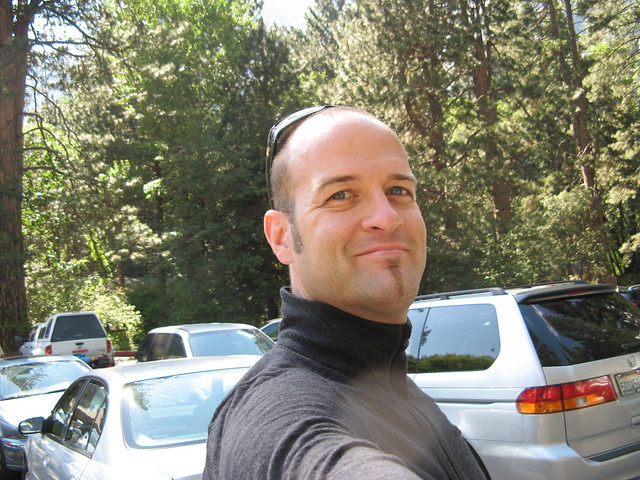
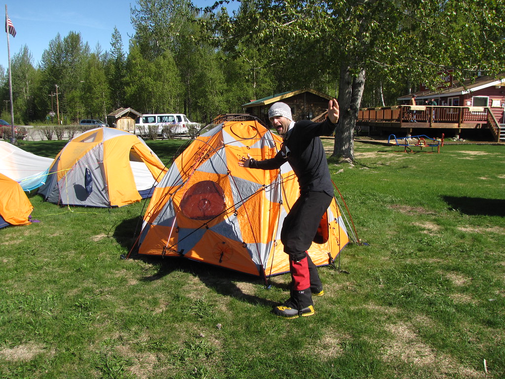
I got up early today so I could have breakfast at a little place on Shasta Blvd (isn't EVERYTHING on Shasta Blvd here? haha) , but before I went for food, I scouted the location of the climbing store where I was to meet up with my climb team. There were a few people starting to congregate out front, but he 5th Season's doors were still closed, so off I went to grab a bite. Tasty… eggs benedict, some pancakes, and the like.

Afterward, I headed back to the store, which was now open, and met my guide for this trip, Rich Meyer. He's a big, burly dude with a big personality, and I figured we'd get along just great. My fellow climber was a guy named Rutherford (uh… really? Who names their kid "Rutherford"?), a slight, and gooshy fellow of what looked to be about 38 , sporting some goofy glacier glasses, pasty skin, a weak chin, an unbelievably wicked combover, and a very quiet walk-behind-the-man kind of GF/wife in tow.

Apparently Rutherford has climbed a lot of huge mountains in Europe, South America, and other places in the world, and rattled off an impressive resume of major peaks when Rich asked him what mountaineering experience he's had.

That was a bit of a surprise, given his appearance… but then appearances can be deceiving. No matter how you slice it, though, Rutherford is a weird dude, and so is his partner/wife/GF.

I found out later on the trail that she is from Russia... maybe she doesn't speak any English, or is a quiet mail-order bride or something… but I'll get to that whole bizarro experience on the trail in a minute haha)
Nevertheless, my paltry experience just sounded stupid by comparison. haha

The three of us finished our preliminary gear check out back, stashed the stuff that didn't make the cut, and it was at this point that Rutherford began wondering aloud to Rich about things his GF would do while he's gone for the next 3 days, since she wouldn't have a car.

Wait, what? Why doesn't she drive you to the trailhead so she can keep the car? Ohhh… she's a halfwit… I see. And she doesn't drive, and the implication is that she's also completely incapable of figuring out her own program while the big bad nerd-climber is away? Wait, why didn't you guys think of this before coming here in the first place? You've had months to figure this out.

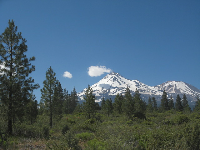
The Hotlum Bolam Ridge is the spine of
rock about halfway up that runs upward from left to right,
starting just left of center
He made the decision to leave her behind, carless for three days in Shasta City while he conquered the mountain… (so weird), and then we all struck out in separate cars caravan-style northward, heading around the western flank of the mountain toward the trailhead. As we drove, the route we were to climb came into view, too... pretty incredible.

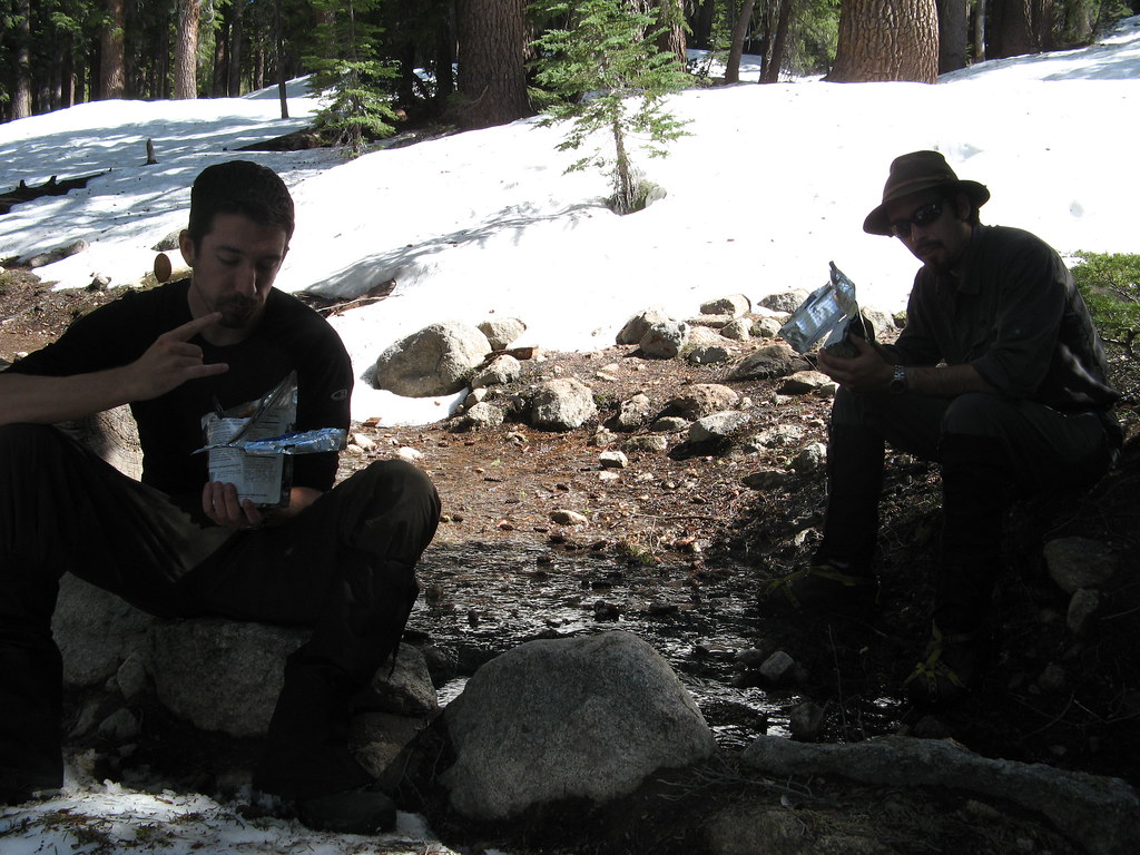
Our turnoff was Military Pass Road, a long, very dusty, and bumpy road that twisted up into the foothills and snaked around the northwestern side of the mountain to the North Gate trailhead. Here, it was officially time to get climbing. We parked the cars, changed into our climbing gear, and took the last civilized bathroom breaks we'd have for a while.

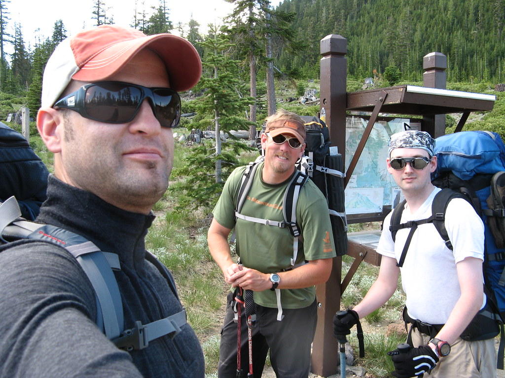
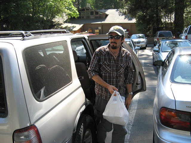
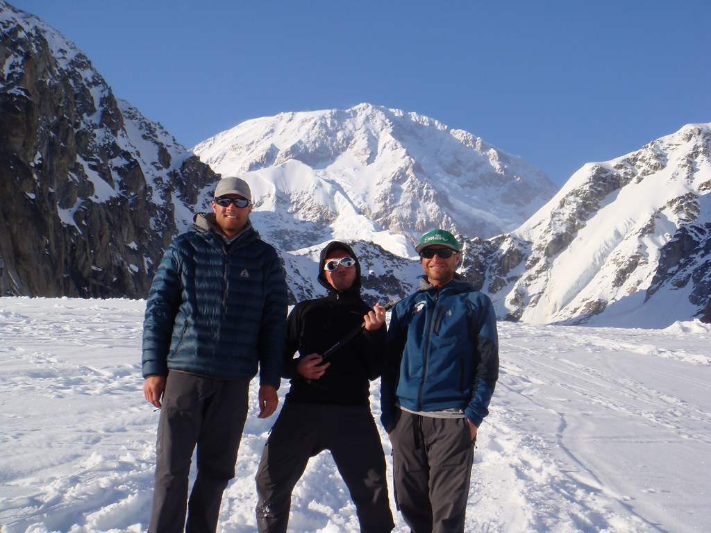
Me, the awesome Rich Meyer, and the impossibly weird Rutherford
On our way past the Forest Service trailhead signs, we registered, paid our summit fees into a dropbox, and ohhhh yeahhhh, picked up the obligatory poop bag packs. Yeah… you have to carry your crap off this mountain, too :-)

*ahem* I will now detail the standard poop kits provided by the Forest Service:

1. A brown paper bag with some kitty litter in it

2. Large fold-out paper target (!!) for aiming properly

3. A pair of ziploc bags

So when you need to take a dump while on the mountain, you take out a kit, pull out the paper target, unfold it on the ground and put a rock on each corner, and hope your aim is good as you shoot for the center of the target. When you're done, fold in the corners and roll it up like some crazy, weirdo poop burrito, put that into the paper bag, then put that roll of warm happiness in the Ziploc, and then put the whole thing into the second ziploc. If you're careful, I'm told, you can use each one twice, which precludes the need for carrying more. They're bulky, and they take up room and add weight to your pack, so less is better. AWESOME! Hahaha

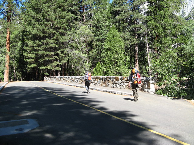
With all our crap sorted (so to speak), we at last headed up the trail for a 4-ish hour climb into the moraine at the snout of the Hotlum glacier where we'd pitch our base camp.

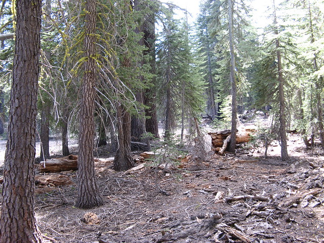
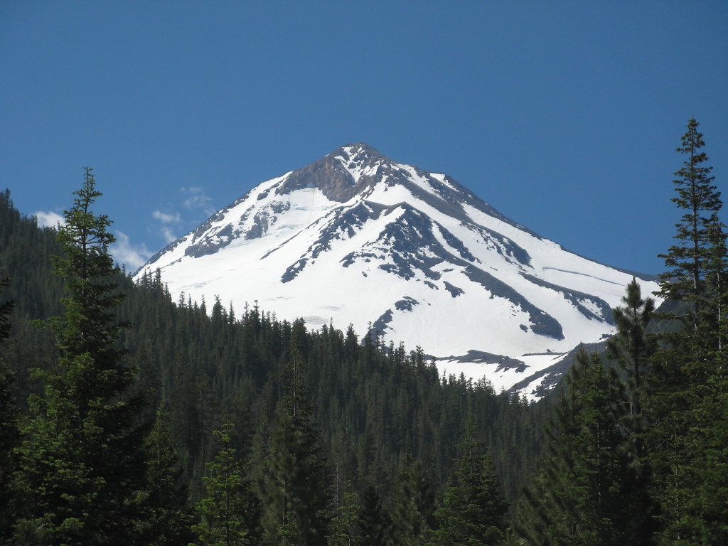
Beautiful, dense pine forests on Shasta's north side
It was a hot day, but there was plenty of shade to be had, and with Rich in the lead, me second, and Rutherford bringing up the rear, we talked and hiked. Mainly, it was Rich and me talking. He'd shout something back over his shoulder, and either Rutherford or I would answer, but then Rich and I sorta settled into the usual "why we climb" kind of discussion… the risks we take, the people that die doing what they love in the mountains… nothing too out of the ordinary or sobering, but it lasted about 40 minutes, throughout which Rutherford was mostly quiet, only chiming in a few times.

At almost exactly an hour up the trail, Rutherford speaks up behind me.

Rutherford: Uhhh… guys… Can we stop for a minute? I can't be here. There's something I have to take care of.
Rich: (thinking Rutherford had to take a dump) Sure, man… We can just wait here while you go do your thing.
Rutherford: No, I mean there's something I have to do. I really can't be here.
Rich: Yeah, seriously, no problem. It's cool… we'll just wait here and…
Rutherford: No, I mean like I have to go do something.

I was just as confused as Rich at this point. "WTF are you talking about, dude?" is what I was thinking. HAHA

Rutherford: I've just been thinking for a while, and I realized I shouldn't be here, and there's something I have to go take care of.
Rich (realizing what dude is talking about): Ohh, wait wait wait hang on a minute… you mean you need to TURN AROUND and go back down?
Rutherford: Yeah.
Rich: Ohhhh… wow… *stunned* Hmm…. Well, this has never happened, so
Rutherford: Yeah, but I'm really ok, I'm fine. I just can't be here.
Rich: What's wrong? Are you not digging the conversation? Was that bumming you out, or what?
Rutherford: No, the conversation isn't what sparked this… I just can't be here.
Rich: Are you feeling ok medically? Are you lightheaded or feeling dizzy or sick or anything? Are you hurt? I mean, I don't wanna get into your business, and now I get what you're saying, but by the same token, you have to understand, I'm responsible for your health and well being up here. I can't just let you turn around and go back down by yourself, so you've gotta give me SOMETHING that tells me what's going on. All three of us would have to go down to take you back if I don't think everything's cool.
Rutherford: Nonono, I'm totally fine… I just realized I really should go take care of this, and I can give you guys back the group gear I'm carrying, and such…


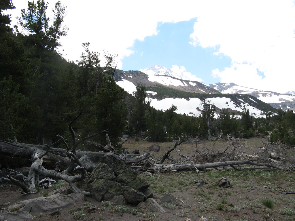
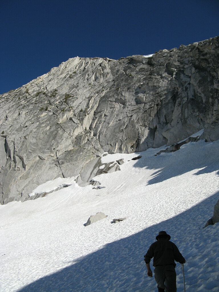
Heading toward the alpine zone after
Rutherford's bizarre departure

It went on like this between them for a bit, Rich doing his due diligence, me going "OMG! WTF!" every five seconds at this dude's el bizarre behavior. Made me wonder if the talk about why we climb WAS getting to him, and he was feeling extraordinarily bad about leaving his strange wife behind for three days—carless—while he's out on a mountain enjoying himself. He denied it, but, still… I dunno.

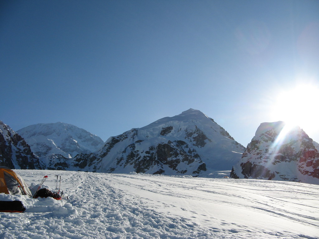
Anyway, after it was determined that nothing was wrong with Rutherford *uhhh… relatively speaking haha*, an arrangement was struck for him to go back down the trail alone and immediately contact the head of SMG to let him know he got down ok. Then we traded tents and shuffled some group gear around, and then Rich and I continued the cruise up to 10,000 feet and a comfy basecamp in the glacial moraine.


Finally above treeline... and onto
the lower snowfields
 We made good time and found a good spot in the moraine near some pure, running glacier water streams, pitched camp, and cooked a hearty dinner. We had way too much food for the two of us now, so we ate heavy and enjoyed every bite, storing up our energy for the coming summit climb tomorrow.

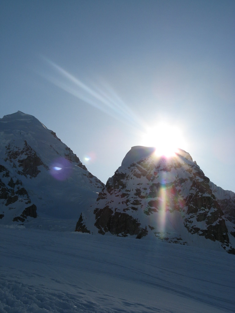
A breathtaking sunset washing us in bright pink and orange hues combined with brilliant colors out over the valley and behind dramatic outcrops of nearby rock were our reward for today's hard work.


The final grunt up that snowfield leads to 10k basecamp
 The views from there are phenomenal, too. Rich and I put on some puffy gear to keep warm as a light breeze kicked up, and stayed up for a while chatting, but ultimately went to bed early for an alpine start at 2am.

Realllly looking forward to the climb tomorrow.

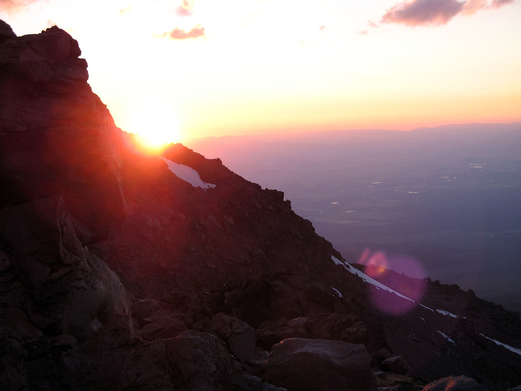
Sunset from 10,000 feet on Shasta is a beautiful thing.


Monday, October 18, 2010

July 17, 2010 - Shasta City and Mt. Shasta's northeast side


Mt. Shasta in the distance. Avalanche Gulch is the huge
bowl on the right side of the mountain
Watch for links to video below, and click on the pics for larger versions!

Mt. Shasta has been on my radar for some time, now. At 14,178 feet, it's a breathtaking and imposing monolith that towers over the tiny towns of Mt. Shasta City and Weed, and now that I have the foundation mountaineering skills and some background from my time in Alaska, the time has finally come to climb it.


(Weed itself is a place that holds many memories for me, too. My band Trip Device recorded part of our album titled "Inside I Feel" at Radiostar Studios (in Weed) with multi-platinum Grammy-winning producer Sylvia Massy at the helm... cool days.)

Me... on the long drive.
 Anyway, having just returned in May from 10 days of mountaineering skills training, I felt confident I could tackle something on Shasta that was a little more challenging than the standard south side Avalanche Gulch route. As beautiful and challenging as Avy Gulch certainly is, I was looking for something on the mountain with a little more oomph.


So I did a little poking around on the internet to evaluate the skills required for a number of routes, talked to the people at Shasta Mountain Guides, and ultimately booked a 3-day guided northside climb up the Hotlum Bolam ridge: the ridge that divides the Hotlum and Bolam glaciers. It seemed to me a perfect route to continue pushing my skills as a climber: it's glaciated, has lots of sustained vertical, and has variations with access to steeper terrain.

I wasn't quite as maniacal in my training for Shasta as I was in preparation for Alaska. The fact that I'm already in excellent climbing shape, and that my expected pack weight on Shasta is considerably less--more like 35-45 lbs for a 3-day trip--meant I could spend most of my energy on training for altitude more than strength and endurance.
  
From left: Sylvia Massy, Rich
Veltrop and me @ Radiostar
Studios in Weed--RAWK!

But train across the board I did anyway, complete with pack and gear, and at last (as is always the case if one waits long enough haha), the day came.

I drove out of San Jose on Thursday morning, embarking on the 5.5 hour drive through beautiful stretches of northern California to give myself time to pay a visit to Sylvia and Rich at Radiostar. I arrived in Shasta City with plenty of daylight left, and because the whole town is mostly clustered around the main drag, I had no difficulty finding my hotel for the night.

I gave Sylvia a call, and headed over to Radiostar. When I arrived, there were what seemed like swarms of 8-10 year old kids milling around (and their parents). Turns out those kids were in a metal band that Sylvia was working with, and they're apparently awesome haha The kids certainly had quite a lot of energy (and a few mullets and Metallica t-shirts), so I can only imagine what the music was like. Cool to see haha

After a cool chillout and (OMG, the cappuccino!!!) chat with Sylvia and our brilliant engineer Rich (and a guy named Fernando who's interning at Radiostar and, it turns out, went to HS with Steve, my drummer in Fremont, CA haha weird), I headed back to the hotel to get some rest for the coming days. I found a bite to eat, and then stopped in at the Veteran's Club (the obigatory drinking stop on Shasta Blvd), but found it mostly devoid of people, so I decided to hit the hay.

Tomorrow begins the climb of my first 14er.

Sunday, October 17, 2010

June 28, 2010 - Tresidder and "Finger Eleven" (Monday)

Watch for links to video below, and click on pics for larger versions!!


Our incredible campsite at the base of Cathedral Peak
With plenty of time for climbing today, we slept in a little this morning, and woke to the soothing sounds of snowmelt runoff from the slopes across the lake that had lulled us off to sleep the night before.

Cold, crisp mountain air and a spectacular show of bright white-and-blue-tinged morning sunlight caressing the towering granite cirque walls all around greeted us as we exited the tents, too--and man, I can't think of a better, more majestic way to wake up.

The original overall plan for yesterday and today, of course, was to climb Clouds Rest yesterday, then Half Dome today, but because of all the misinformation we received (and the ensuing craziness down in the Yosemite valley a few days ago), we'd since decided to just scrap the latter two peaks and let it ride... just pick objectives on the fly and see what the days brought us.

Luckily, as we discovered, theTuolomne area rewards such decisions with unimaginably beautiful and myriad opportunities for seat-of-the-pants exploring.

Dan, and a distant "Finger Eleven"
An epic breakfast burrito like the previous day's--a concoction for which I simply MUST come up with a name one of these days--accompanied by coffee, cider, and some oatmeal made for another spicy, hearty start, and soon we were walking out of camp, heading downslope off the flanks of Cathedral Peak in a southwesterly direction, toward the glittering Cathedral Lakes district to see what we wanted to climb.


A look back at our line on Cathedral
Peak. You can see

We'd briefly considered walking south a few miles to do the Columbia Finger, but ultimately decided on a pair of twin peaks just north of that: Tresidder and a jutting finger of rock joined to it on climber's right by a huge bowl and col / ridge with no apparent name on the topo map. With a 10,000+ foot summit, we decided it would be fun to bag that one, too. We dubbed it "Finger Eleven" (pic at right), and undertook ascending it first.


Tresidder Peak
We'd gone light and left the crampons behind, opting for just ice axes to keep us secure on the moderate snow and rock slabs up through the bowl to the summit and connecting ridge. Good call. One highlight of the approach hike was a dramatic network of rushing waterfalls in the forested and snowy granite hills, and it gave us pause a few times to find a good way through without falling in and getting wet--a legitimate concern at this point, given Dan's proven propensity for falling in rivers haha. "Don't fall in, Dan. No running into the river this time."

We negotiated it successfully, and right around the spot where we took our first break--a gorgeous narrow ridgetop--the massive hulks we intended to climb came into view as they began to peek over and between a set of undulating ridges and valleys that ran longitudinally from our position. We had some amazing vews of Echo Peaks to the left and rear, and looking back toward our point of origin, we were now able to see a completely different perspective on our line up Cathedral Peak and the Eichorn Pinnacle yesterday.

There was tons of fresh running snowmelt water all over the mountain, so finding a water source and refilling our bottles was never much of a challenge. At one water stop halfway up Finger Eleven, we spotted a marmot wandering around on the mountainside... super cool. Haven't seen one of those since I was a kid!

The cliffs beneath Finger
Eleven's summit
We continued upward, the spikes on our ice axes alternately clinking on acres of solid granite slab steps and crunching in soft-ish midday snow. We went pretty much straight up the right shoulder of the gigantic bowl between Finger Eleven and Tresidder, bearing for a band of cliffs near the top that sported what looked like a notch we could shimmy up through.

As we approached that band of cliffs, though, we ran into a wall none of us were comfortable climbing without proper protection, so we instead skirted around left and upward, and then we popped out on the broad, gravelly summit ridge, basked in bright midday sun.

A big standalone 10-foot high outcrop of granite boulders in the middle of the clearing appeared to be the highest protrusion around, so we scrambled up it and called that the summit, after which we did some exploring out on the actual finger of rock we'd been seeing all day long from below.

The summit of Finger Eleven. You can see upper Cathedral
Lake in the background onthe right side of this shot.
Turns out that finger of rock was a stack of boulders that fell away sheer on three sides, with thousands of feet of exposure to the north and west sides, plus several hundred on the eastern side that dropped steeply to a snowfield that plunged all the way down to the shores of Upper Cathedral Lake. Dan and Peter climbed out a ways on the outcrop, and I snapped some pics. The views were 360 degrees, and just unbelievable.

We ate some lunch and goofed off up there for a bit before deciding to do a traverse of the ridgeline that connected Finger Eleven to Tresidder.

Me on Finger Eleven, Tresidder's
pointy summit blocks in the
background.

Once off the summit of Finger Eleven, we dropped down a few hundred vertical feet before gaining it again on the ridge approach to Tresidder's summit pinnacle blocks. It was an easy traverse across the mountain to Tresidder's massive, spur-filled granite block summit. The climbing was pretty solid, but again, my mountaineering boot stiffness was causing knee roll problems that would have sent me off the wall to a possibly quite serious injury, so again, I stayed below after an attempt to scale it.

Dan and Peter on the summit of Tresidder
Peter and Dan had no such problems, however, because they were in their much more flexible hiking boots, so up they went, and conquered the tower. Radddddd!
 
It was time to head back to camp. The snow was getting soft enough, so in keeping with my strict adherence to a backcountry policy of leaving only assprints behind (haha), we glissaded down the steeper part of the Tresidder bowl, and heel plunged our way back down the rest of it. And randomly, a little lower during a top for some reason, a frickin snowball fight broke out between Peter and Dan! WTF! HAHA

After I turned the camera off for that clip, we paused for a minute, and then Peter asked me to turn the camera on again. Not knowing why, I obliged. Apparently, Peter had decided he could take Dan down in a snow wrestling match and wanted it on video, but... Hmmm... instead (complete with video proof), he got his ass handed to him.

Tresidder on the left, Finger Eleven on the right
HAHA that was a random outburst, though, and funny! I wonder if AMW (Acute Mountain Weirdness) is a legitimate high altitude medical condition? Anyway, we made it down safely, and a look back over our shoulders a while later clearly showed us what we'd accomplished that day. Not bad!
Shortly thereafter, we arrived back in camp after the climb of Tresidder and Finger Eleven, where we ate, relaxed in the dappled late afternoon sunlight and generally reveled in the brilliantly perfect weather we were experiencing.

We chillaxed for a while--and then I think I musta contracted my own case of AMW. After some lazy time basking on sun-soaked rocks at the edge of the lake in our bare feet, we decided we wanted to saddle back up and hike around the lake, and up the Cathedral Peak basin we were camped in to see what we could see, and maybe do some more sliding.

Climbing the snowfield
beneath Cathedral 
With ice axes in hand, we climbed up to the little bergschrund of our private little snowfield amphitheater and did indeed enjoy some long glissades back down to the bottom of the upper bowl. It was FANTASTIC fun, and perfect weather for it--and once again, the vistas were panoramic and mindboggling.

There were several great moments: Dan accidentally crushing his balls on his first slide down, all the while filming his own ball-destroying POV with another video camera; Peter's flailing last ride down the hill; me, being nearly killed by a monstrous claw; Peter, unintentionally striking a positively Sir Edmund Hillary On Everest pose for a photo... the list goes on. :-)
On our second climb back up--because on a slope like that, just one slide is never enough--Peter attempted to roll a huge chunk of ice down the hill, but unfortunately, failed. The whole angle of repose thing... in action!


Me, sliding the Cathedral Peak cirque's snowslope

Eventually, my turn came for sliding, and off I went down the hill. It was totally awesome. Between the long slides down the slopes of Tresidder and the two big glissades here at camp, we got a LOT of slipperysliding in! WAY fun. And then we stomped our way back down to camp, cooked some more food, and yep... I'm pretty sure by this time, we all had seeeerious AMW.

There was some subsequent discussion about whether we ought to pack up tonight and hoof it back to the car and go stay in Peter's family cabin just outside the park, but there seemed no reason to rush away from such serene surroundings.

We spent the night, awoke early, broke camp, and headed back down to the car on Tioga Road amid the worst swarms of mosquitoes I think I've ever experienced. We were eaten alive, and were still killing insects miles down the road that had flown into the car to get us while loading up to leave as hastily as we could.

All in all, this was an amazing, memorable, spectacular experience... and now I'm soooo hungry for more Tuoloumne. :-)


Saturday, October 16, 2010

June 27, 2010 - Yosemite Valley and Cathedral Peak (Sunday)

Watch for links to video below, and click on pics for larger versions.


After a kooky night that included Dan bolting out of the tent and barfing his guts out at 3am for no reason whatsoever (!!), we cooked up a hearty breakfast -- where I realized just how excellent my choice of breakfast food for this trip had been.

This was my first time trying it out, but as I was assembling it in my kitchen before the trip, I knew it was gonna be good: warm flour tortillas stuffed to the gills with cooked diced potatoes, onions, and green peppers, plus crisped up spicy mini pepperoni slices and a couple chunks of bacon, all doused in sriracha, rolled up tight and crammed down my hungry pie hole. OMG IT WAS GOOD!!!!

Of course, the requisite teasing of Peter about his "issue" with his sunglasses the day before was in order, after which we (ARRG! AGAIN...!) put on packs, left the backpacker's campground and started walking the long path down to the shuttle stop to catch the 10:55am bus the dispatcher last night had said would come and take us to Tuolumne Meadows.

About halfway there, it finally hit me (like an idiot!) after nearly two days of hoofing it around under heavy packs with all kinds of winter gear attached to them in 85 degree Yosemite Valley temps: why the HELL have we been walking these paths back and forth and back and forth with heavy packs on??? There's a free shuttle system that runs the whole loop of the Yosemite Valley!!! GRRRR... HAHA Oh well... too late now.

As we were walking, I noticed a strange squishy wetness running down my back, into my pants, and down my legs. ACK! My Cambelbak bladder had split, and it was slowly leaking its 100 oz of water into the world. Dammit.

Anyway... we reached the shuttle stop a little early, and had time to do a quick doublecheck of the dispatcher's information with what was posted at the stop. The doublecheck revealed that the information we'd been given was completely wrong (no surprise at this point), and if we wanted to stick to our original plan of shuttling up there, we would have to wait til 5pm tonight to do it!!!!

At this point, having been completely frustrated and hosed by the dispatcher the night before, we were faced with a couple of options:

1. Leave the car here and shuttle to Tuolumne at 5pm--late--summit like we were supposed to, and end back in the valley after cutting short our time by a day.

2.Drive ourselves to Tuolumne, do the original route, end back in the valley carless, and then send Dan or Peter hitchhiking back up to the Meadows to get the car (which would have resulted in a VERY long wait for the people left behind in the valley, OR...

3. We could just drive ourselves there, fart around in the Tuolomne area, and instead pack in and out to and from our car there. Not the original plan, but #3 ended up being the best, smartest, and fastest way for us to finally leave civilzation behind and get out into the wild.

Soooo... back on with the heavy packs, and still more trudging, this time back to the car once more to drive ourselves to Tuolumne so we could at last kick this thing off. The drive to Tuolumne Meadows was uneventful, but about two thirds of the way there, all three of us began to notice the alleged "4 feet of snow" from the dire warnings of the rangers in the last few week just didn't seem to be materializig as we drove higher and higher.

When we at last reached our destination, parked the car near the trailhead, got out and looked around, every one of us realized that we'd never SEEN so much snow. The level of retardedness of the information on conditions we were given was quite mind-boggling.

As it turns out, it was lucky we DID suffer all the shuttle drama and difficulty down in the Yosemite valley that forced us to drive ourselves here. If we hadn't, we'd have taken a shuttle here carrying every piece of gear the rangers said we needed , and been forced to carry a lot of extra weight we just didn't need.

We hastily stripped down our packs to just the stuff we needed and left the rest behind in my car, and (at long painful last) managed to get on the trail upward and inward--toward Cathedral Peak.

As we hiked, we ran into a bunch of people coming out toward the road. Bizarrely, every party gave us dire warnings about getting lost in the snow up ahead, and freaking out about how they'd gotten lost themselves and wasted many hours trying to find their way back.

To us, it just looked like they were ill equipped--or they just weren't thinking when they headed in in the first place. I had difficulty imagining ANYONE getting lost in such an approach area... seems a little ridiculous to me if looked at a map, you're following your landmarks and have any kind of basic idea how to navigate in the wilderness. We even ran into a few parties of bigtime backpackers who you'd think would have that skill... but apparently not. LOL

Anyway, we encountered our first significant snowfield on the trail about an hour and a half up the trail, but we stuck to our original plan--to traverse around the base of the back of Cathedral and continue toward our destination.

Dan and Peter were lots of fun, and Dan is a great navigator who did a great job of keeping us on course and heading up to where we needed to be. Having never been in the area before, I was glad he knew where he was going. :-)

And then, just cresting a ridge, we happened upon one of the most startlingly beautiful places I've ever had the privilege of witnessing in the wild--so we decided to set our camp there (but later... there's still climbing to do today).

We dropped our heavy packs and stripped the weight down to a couple liters, a length of 6mm rope in case we needed it, and generally went a lot lighter. We started up the Mountaineer's Route on Cathedral Pe and akmade really good time, and soon enough, we were halfway up the mountain with about 800 vertical feet to go.

The higher we went, the terrain got rougher, and we had to pick our way up the shoulder of the mountain more carefully. Eventually, it changed to class 3/4 scrambling over huge boulders and talus, grown through with tough scrub, and the terrain got tougher still.


Eventually, it became apparent that the stiff mountaineering boots I brought with me on the errant "OMG, SNOW!" advice of the park rangers might actually be more problematic than helpful the closer I got to the summit, and as the terrain became increasingly more fragmented.

The problem, I found, was that although they're quite flexible in the ankle **for mountaineering boots**, they weren't flexible ENOUGH, and forced my knee outward involuntarily during climbing moves, which threatened to roll my toe off whatever foothold it had purchase on in the rock--Mostly fine, but kind of dangerous in spots with more exposure.

Also, we'd left our crampons and ice axes behind at our campsite (thinking we wouldn't need them), and although not super exposed, ahead was a large snowfield with significant enough exposure from a slip with no way to arrest that you could easily fall down the huge trough at the base of the Eichorn Pinnacle on your way the valley floor 1,500 feet below.

I wasn't comfortable with that, given the gear I had with me (and that which I lacked), so I pretty much decided a couple hundred vertical feet below the summit that it would be unwise for me to continue farther up the mountain. Dan and Peter thought it over and decided to press on toward the summit.

Our designated turnaround time was 6:45pm, but they made slower progress than expected over that snowfield and upward toward the summit since they'd left me, carefully picking their way across to find a reasonably safe route, and they shouted back to ask for a few more minutes.

I wasn't too concerned, given the fine weather and the fact that there was plenty of daylight left, and that we had no significant soft snow or rockfall hazard to deal with on the descent.

As I waited, I had a chance to observe my surroundings, and I was just blown away, especially knowing that around the ridgeline across the snow was a sharp nearly vertical cliffdrop straight to the valley floor.

Dan, an experienced rock climber, and Peter both reached the highest point on the mountain below the unique spire of rock that marked the path to the true summit 20 feet overhead before deciding that their lack of rope and some minimum protection made ascent of the final summit block unsafe. Bummer... they had to settle for stopping just below summit. Smart choice, however.

It was a spectacular, safe ascent with no incidents, and it was an unbelievably beautiful day, and as we descended back to our campsite, the vistas we just staggering. Hard to believe this is just a few short hours from my front door, really.

After descending the high boulder fields and steep, rough rock, we walked back onto stable snow and rock along the dazzling shoulder of the alpine lake cirque, at the base of which the rest of our gear was parked.

The sun began dropping lower into the sky, and slight tinges of orange started to come out, and as we cruised back into our chosen camp spot for the night, we looked up and saw the cirque bathed in reddish orange hues that just took my breath away. The peaceful silence, broken only byt the sound of the snowmelt rushing out fron under the snowfield across the lake, was powerful, cleansing, and utterly sublime. Just an unbelievably beautiful place to camp. (We theorized that camping here might not actually be allowed, but we weren't entirely sure -- so we went for it.) P.S. Bear canisters SUUUCK.

We pitched the tent, filtered some water to refill our bottles, cooked up some stupendous hot meals, it got dark... listened to the bats... and crashed. a completely awesome day.


Friday, October 15, 2010

June 26, 2010 - Yosemite Valley (Saturday)

Watch for links to video below, and click on pics for larger versions.

11:40pm
Today was a pretty wacky piece of adventure comedy.

A while back, a new friend of mine, Dan--knowing I was training for a guided climb of the northeast side of Shasta in a month or so--kindly invited me to go with him and two buddies on a 3-day, 3-summit weekend excursion into the high country of Yosemite. He thought it might be a good training ground for building on my skills from Alaska--and he was right.

Being that this was to be an "early season" climb starting in the Tuolumne area, though, we needed to know how to prepare. Snow? Dirt? Ice axes and crampons? How cold was it? In the weeks and days leading up to our departure, we all made a few calls to the park ranger station to stay in touch with the changing conditions so we didn't overpack, or worse, show up on the mountain without something we really needed.

By all accounts from every ranger we talked to, the entire Tuolomne area was still under 4 feet of snow, and required snowshoes for backcountry travel, though there was little to no avalanche danger in the areas we were headed, as the snow was all pretty well consolidated by this time of year.

OK... no problem. After a bunch of back and forth on whether we were going, snow or not, Dan's second buddy bailed, we packed accordingly and Dan, his buddy Peter and I set out from the Bay area for our weekend excursion. We made pretty good time (except for the part where Peter... uhh... "lost" his sunglasses... HAHA), and we arrived in the Yosemite Valley around 3:30pm.

The original plan was to park the car in the Valley and take a shuttle up to Tuolumne Meadows and pretty much hike and climb our way back. The idea was that we'd hit 3 summits along the way: Cathedral Peak (10,700 feet), Clouds Rest (9,926 feet), and Half Dome (8,842 feet), ending back in Yosemite Valley near the car in early afternoon of day three. Pretty straightforward.

Upon arrival in the Yosemite Valley, the first task was to go pick up our permits at the ranger station's permit office. Peter and I waited in the parking lot for Dan to run in and back out with a permit in hand--and we waited--and waited. Eventually, Dan came back, frustrated but anxious to get going. Apparently there were a zillion stupid people in the permit line who had no idea what they wanted to do when they arrived, and were using the window personnel as tour guides to help them decide. Ugh.

The wait killed nearly all the time we'd planned to park, pack up, and hoof it back to the shuttle pickup area to catch the last ride of the day to Tuolumne at 5pm.

By the time we got parked (after parking once, getting out of the car, saddling up with packs, getting a ways on foot and then realizing we should be parked in another lot across the valley), we had about 15 minutes to make the run, so we hastily saddled up our packs (again) and headed out (again) on the run across the valley.

We took a long footbridge across a swampy meadow and headed straight across the middle of the valley, thinking we'd just meet the loop road on the other side and cut off some time. (We realized later we should have turned left and headed down the road instead... but that's a whole other thread to this story.)

Almost immediately (but invisibly from our takeoff point) we found ourselves blocked by the Merced river, and try as we might, we just couldn't find a suitable crossing.

With just 5 minutes remaining to catch the last shuttle of the day and all of us sweating like hell from running with heavy packs, we spotted a logfall across the river. In desperation, we went for it.

And like a lot of things out here, it turned out to be tougher than  it looked. The river was only about 30 feet wide at t his point, but the connecting log network was less than stable, and not completely accessible all the way across.

I was looking down, focused on making sure my own feet landed on the right logs, but up ahead, I heard a loud crack. I looked up from my own precarious crossing just in time to watch Dan teeter under the weeight of his pack--and fall into the river.

The spot he went into happened to be a deep trough under a huge uprooted tree on its side, so he was able to keep himself from going in completely by scrambling, flailing and struggling to grab hold of the roots. He went in up to about his chest, pack, boots, and all.

Pretty alarming... the current was strong here, and I was too far away to be able to reach him in any sort of rapid fashion, but I called out to him to make sure he was ok. Peter, who had crossed first and was already on the far bank, heard the same loud CRRRACK! I did, alertly spotted the problem, dropped his own pack on the shore, and bounded back out the fallen logs to help. He grabbed Dan's pack and helped haul him out of the water, and then grabbed one of my Nalgene bottles that was floating away. (Like an idiot, I'd dropped it while fumbling to get it onto a gear loop so I could go help Dan.)

Finally, we all reached the far side, wet, out of breath, and still far from our destination shuttle stop.... FOILED! We threw or packs back on (complete with snow shovels, crampons, and other cold weather gear strapped to the back) and trudged down the valley a ways, and then realized our best alternative for staying the night would be to go pitch camp at the backpacker's campground. It was quite far out of the way, presumably so that paying park tourists (a.k.a. the revenue stream) don't have to see the smelly, dirty, tired backpackers that are a constant in Yosemite.

So we walked back to the car and drove to the backpackers campground. Ugh. After we got camp set up, it was starting to get dark, and we began to consider our food options for the night: get the stoves out, or walk back down to the village and get pizza and beers at the lodge. Hardly a choice, so we zipped up the tent and hoofed it once again BACK toward the village. Along the way, we walked past the spot where Dan and the Merced river got to know each other. It was a long way to the lodge in gathering dark, but the payoff was awesome. A good pepperoni, olive, mushroom, and bacon pizza can cure many ills, and we were soon laughing and chatting again.

After dinner, we decided as long as we were in the area, we should track someone down who could help us figure out when the earliest shuttle to Tuolumne departed the valley, and we found what we thought was the best POSSIBLE person: the head shuttle dispatcher herself! We told her of our troubles, and after much hunting and radioing of other people to double-confirm, she informed us that the earliest shutle in the morning left at 10:55am. Perfect... no early rising necessary to break camp!

It was about this time that I spotted a sign on the dispatcher's building that my buddy Todd would reallllly appreciate. Armed with this new information and now confident of our plan, we then marched back to camp--in pitch black, mind you, because none of us had thought to bring a headlamp to dinner--at dusk---stupid haha)

When we got there, we pulled out the headlamps and gathered around the maps we had of our original proposed route to see we could still pull off the route we intended with the new shuttle schedule. We decided it was still possible, as long as we got ON the shuttle in the morning... guess we'll just have to see! :-)

Thursday, August 12, 2010

Epilogue: Talkeetna, AK - May 22, 2010

Watch for links to video below, and click on pics for larger versions.

I woke this morning with a pretty good headache, and I look (and sorta feel) like death haha. Too much partying last night, I guess haha. I didn't get to bed until deeeeeeep into the morning hours... people kept buying round after round and slamming 6-ers on the table! What's a boy supposed to do? Sheesh. I think Denis and I were some of the last few people left in the Fairview Inn at closing time.

Luckily, some extra special anti-hangover medicine was made available at the table, and actual food included another pair of those mindblowing cinnamon rolls from the Talkeetna Roadhouse. After that, we all went back to the TeePee to get our crap and met in a back alleyway behind Denali Overland Transport--a weird combination of gift shop and shuttle service--to load up the van for the drive back to Anchorage. And already I longed for just one more look at the terrifying ridges of Mt. Hunter that I'd been staring at all week long.

It was a long drive. Or so it seemed to me, anyway. Reason is, I've had to PEEEE all morning, and I keep forgetting (this entry seens to be generally rather bathroom heavy hahaha).

Along the way, we stopped for coffee at a great little roadside stand in Wasilla for some excellent espresso, and then, like an idiot, I managed to get back in the van, sit down, and enjoy my espresso long enough to oops... realize I hadn't take a leak as the van started to move again for the next leg of our journey. Doh!

Aside from that, however, one of the things I learned on the drive back -- once again from Tyler -- was that the first big mountain range we'd driven through on the way in from the Anchorage airport to Talkeetna 10 days ago was the Chugach Range. He also informed me that it was visible from the Anchorage airport. I didn't even realize I was taking pictures of 10 days ago... (!) AWESOME!

But why is this really cool? Because the Chugach Range is very high on my list of places under consideration for my first heli-ski trip. Tyler mentioned an especially interesting fact about the Chugach that actually explains why it's such a good place to heli-ski: although the summit elevations of most of the mountains in it are rather unimpressive with numbers around 8,000 and 9,000 feet, the lowest points of the range pretty much dip into the sea, which means almost ALL of their 8,000 or 9,000 feet height is prominence--meaning exposed and skiable (or climbable).

On another mountain, your base camp might sit at, say, 5,000 feet above sea level, and you might climb from there to an 8k or 9k summit--only 4,000 vertical feet of prominence. A 9,000 foot Chugach peak, by contrast, is almost two vertical miles to its summit from where you start climbing (or skiing down, as the case may be). Many of the biggest mountains in the world have far less prominence than most of the peaks in the Chugach Range--an incredible fact, but such is the scale of things in Alaska.

Arriving at the Anchorage airport was uneventful (other than I finally BOLTED to the bathroom hahahaha) but then, after we all rescheduled our plane tickets, we were left with many many MANY hours of a whole lot of nothing to do--with my fellow climbers (Denis, Jeff, and Paul shown here).

I think I had something like 13 hours to sit in the airport and do nothing but think about how much I wanted to just sleeeeeeeep. Once again, I spent a lot of time hanging out at the same bar I sat at on the way IN (but this time with my climbing compadres).

The pizza at that place truly suuuuuucked... especially after such a good one at Mountain High Pizza Pie in Talkeetna the day before. Also, the  garlic knots suuuuucked big balls. Actually, so did the salads--and now that I think about it, pretty  much everything else, too, except the beers. The cheese sticks weren't bad, I guess. Hard to screw up deep fried cheese.

We spent some time wandering the hallways, shopping, goofing off, eating, and eventually, I became extremely bored and apparently rather easily entertained by... the floor...? Hours later, it got no better, and I became STUPENDOUSLY bored.

But the time passed, and as I watched each of my climbing compatriots peel off one by one, each headed back to their own worlds, the lives they left behind, I couldn't help but feel a little sad that it was coming to an end. All I trained for, all I worked for now behind me, and nothing but incredible memories now. And as they left, I became the last remaining RMI AK Seminar 2010 team member in Alaska, left to wander the marble hallways of the concourse for hours on end, a sunburnt ghost of an experience past.

Absolutely, completely, utterly, amazingly, mind-bendingly, incredibly, and ultimately magnificent... and here endeth my first Alaskan saga. Glad to be home safe and sound.


Tuesday, August 10, 2010

May 21, 2010, Kahiltna Glacier and Talkeetna, AK

Watch for links to video below, and click on pics for larger versions.

On a glistening, crystalline morning as beautiful as today, it's sort of a shame that an unfortunate misinterpretation of our plane's arrival time on the glacier turned into another full-on hurry up and wait kind of day again. Also a bit comical... you shoulda seen us move. HAHA

Still tucked in our fluffy warm down bags at around 6am, we all heard Tyler head noisily down toward Kahiltna Base Camp to have a chat with Lisa, the Kahiltna Base Camp manager--and then heard him running back into camp shouting a rabble rousing call to wake us all up. "Get up! Get your stuff together! Pack up! Let's GOOOO!!!!"

Obligingly, we all bolted out of our tents, and now, having moved camp three times, we were able to  pack up camp, get loaded and moving all our packs and bags on sleds out of camp down the snowy trail to "Kahiltna International Airport" in short order, and in a surprisingly organized fashion--only to find once we reached the runway, out of breath and breakfastless, that the misinterpretation had itself been misinterpreted, and that we ACTUALLY had another hour before our plane was set to touch down on the glacier. Doh!
So here we were, standing around in the snow next to the NPS tent, wishing we were all back in our poofy down bags for another hour--or having breakfast--or something. Sooo funny how these crazy things go down out here. :-)

Anyway, NOW there's time to stand around the airstrip, and enjoy the serenely and strikingly beautiful sunrise coming up behind the Radio Control Tower peak we'd climbed several days before, pick our noses, put on  more sunscreen, and... wait a minute... is that Jason about to make coffee on the runway? HAHAHA Awesome!

But then... wouldn't ya know it... just as our heartrates came down and we'd all relaxed, and I'd unpacked the remaining food from one of my stuffsacks into a messy pile of Ziploc bags in the snow to rummage for a tasty morsel or two for "breakfast", sat down on my pack in the snow to snarf while enjoying a leisurely wait for a plane that was still an hour hence--wait... uhhh... what's that soun... omg, THERE'S THE PLANE NOW! Quick, put the food and coffee away! Repack your crap! HAHA

Turns out that the misinterpretation of the misinterpretation that had rousted us from toasty, fluffy slumber in the first place--was misinterpreted! (Ever hear of radios, people? Sheesh lol)

Total goofiness ensued as we split up teams to decide who would fly out first. The weather was certainly good for flying today, but having already jumped all over the front seat position for the flight in, I decided to sit in the middle of the plane this time to let someone else have a shot at it. As it turned out, my decision would have been overridden anyway, because there was some dude riding shotgun that, by all appearances, was from K2 Air's HQ. He seemed to be here to inteview pilots and ground personnel on the status of various operational and performance aspects of the company itself. Weirrrrd...

Whoever he was, he and the pilot proceeded to have a spectacularly boring conversation over the plane headphones for everyone in the cabin to suffer through the entire journey back to Talkeetna, so naturally, I took my cans off for most of it and focused on taking some fresh photos and video of the Range as we departed.

And with delight, I found I could now identify all the mysterious peaks, jagged crags, wicked outcrops, and crevasse-riddled slopes that, on the flight here, I had no hope of deciphering. I took great pleasure in doing so for as long as I could glimpse its staggering beauty.

Watching the snow and ice give way to black, rich, and wet glacial moraine and earth with rivers of crystal-pure glacial runoff snaking its way in giant rivulets in all directions, ultimately coalescing into what would eventually become the Susitna river (and other  major tributaries and waterways) was a reluctant joy.

On the one hand, I was sad to see mighty Denali and the Range fade into the distance behind us, but at the same time, I began to notice my own involuntary amazement at the new-again experience of the flash-flooding of vivid color that seemed to be rushing back into the world around me.

Having spent the last 9 days in a staggeringly beautiful but nevertheless austere world of pretty much just white, black, and glacier blue, seeing the deep and variously green-shaded forests, black earth, blue waters materialize around us below sent my brain into a pleasureable state of information overload.

Speaking of overload, it seemed like the plane was a bit overloaded, and the pilot for this leg of our journey, though clearly more "experienced" (read: old) wasn't nearly as much fun as the other guy. Lots of air miles on this guy.

But what do I care? All that matters at this point is a shower (and a second shower and a third one just for good measure, just to get 10 days of stink off haha), along with a nap and some good food back in Talkeetna, and he did just fine getting us back on the ground.

Once back in Talkeetna, we set to the mundane work of pitching the tents to dry, sorting out group gear, throwing away all the garbage we generated on the glacier (since it has to be packed out) and unpacking and repacking all the other crap we had left behind 9 days ago.

We all also took the time to divest ourselves of all the extra food we'd brought along, so we didn't have to pay the airlines to ship it back home with us. And since the food would all go into the food stores of an RMI Denali expedition two weeks hence that would be led by Tyler, assisted by Jason and Mike, it would not go wasted.

In fact, Jason and Tyler had told stories a few days earlier about how it was possible for a knowlegeable climber to come to the Alaska Range with almost no food at all and eat for free every day indefinitely, because there are so many climbers on the glacier eager to shed the weight of their extra food to any willing takers. I was astonished to learn that there's something of a minitaure grey market here for valuable items like salami, cheese, peanut butter, crackers, extra fuel, and all manner of other desireable, non-perishables.

Anyway, that all took us a few hours, and in the process, Tyler asked Denis and I to pitch the huge Mountain Hardwear Dome tent to dry it out along wit the others--the monster space station shaped canopy that was used to protect our hidden cache from enterprising ravens as we moved up the glacier to climb Mt. Frances on the 18th.

The comedy of this exercise was that neither he nor I had any idea how to pitch this one, but since it was just a drying out situation, we figured getting it perfect wasn't THAT important, as long as ventialtion was able to flow through it.

The lumpy, not-at-all-huge-or-correct tent-like travesty we erected resembled nothing of what a properly pitched MH Dome should look like... this was bumpy, small, lopsided, and totally hilarious--and once again, we cracked up laughing and shot a few goofy photos of us "expert mountain climbers" posing with our misshapen handiwork.

Once done, Denis and I headed back to the Teepee (our motel) for some much needed hygeine. (Lemme tell ya, a single pair or two of underwear just never seemed like enough for 10 sweaty days in the Range. LOL)

Anyway, after cleaning up, we decided to go for a wander through town to see what we could see, picked up Jerry somewhere along the way ("AWESOME!" haha)--love that guy--and maybe find some food and gifts. For food, we decided to go to Mountain High Pizza Pie... where we found Jason, Mike, and Tyler already sitting on the patio with beers and waiting for their pizza to arrive.

They'd ordered a Meat Lover's pizza, which is what we had ordered too, so it was decided that the 6 of us would all split both pizzas, thereby ensuring a constant stream of HOT pizza. It worked out great, and we all got drinking and reflecting and talking more about next plans and such. Good times.

I picked up the bill for the guides and the guys, and now fully satisfied, we set about finding some goodies to take home with us. I found an excellent SuperTopo book on climbing in the Alaska Range, some interesting antique glass fishnet floats that were used by Japanese fisherman in the Bering sea long ago, and are still washing up on shore to this day, and a bunch of other crap to take home... it was raddddd. (I even went for a much-needed espresso, as all the coffee we had on the glacier was dreadful.) Haha

There was some lazy time--chillout in the Teepee, hang out around town, whatever--and then we all reconvened for dinner at Denali Brewing Company's new restaurant, Twister Creek.

Everyone was all tidy now (thank god haha), and we shared a few well-earned toasts, talked more about the future for each climber, and started laying the foundations for our various AK enterprises next May. Sounds like Ben, Paul, and Jerry are pretty serious about going to Denali next year, while Denis and I will hopefully end up on Foraker.

After that came the obligatory partying at the Fairview--and parrrtyyyy we did. It's very strange, seeing pretty girls and nice civilized things after a while out in the wilderness. They smell good, they look good, and it's all brand new again. Odd. Sorta like the whole colors thing I mentioned earlier.

I felt like that old stereotypical image of a dusty, weatherbeaten, interaction-deprived prospector coming in from months in the desert with his mule and seeing civilization again. HAHA At any rate, the band, The Denali Cooks, was awesome. They had a nice, casual, easygoing bluesy-influenced and well-rehearsed, polished sound to just chill out to with lughs and friends, and this night was just what Dr. Ben ordered. (Dr. Ben is on the right... Jeff's on the left, Paul's in the middle of that pic. :-)
On my first bathroom break of the night, I noticed that nearly one whole wall of the Fairview's men's room was a chalkboard, and I was face to face with a huge chalk scrawl for the RMI party, presumably put up by Tyler and Jason (but they denied it). ;-)

I had some cool conversations outside with Jason and Tyler, and shared another cigar. One odd aspect of this whole guiding thing, I've decided,  is gratuities for the guides themselves. Maybe I'm unique in this opinion, but by the time we get off the mountain, we've already paid a shitload of money for the expedition and everything associated with it, and although it's nice for them, they ARE getting paid by RMI to take their teams out and bring them back safely... it's their JOB--and gratuities just aren't that necessary. It would be like me asking for a tip from any customer that uses my company's web site to do something. Silly.

Thing is, it's not like they're getting paid on commission based on the number of climbers they bring back alive, and RMI doesn't give them a reduced salary with the expectation that they'll make up the rest of their living expenses in tips like a waitress might, either.

That said, I don't mind giving them $40 or $50 each as an extra thank you for the experience and knowledge, but more than that seems excessive to me... especially when it's $50 x 3 guides. And I'd already bought a big meal and beers for all three of them earlier. Still... it seemed like they weren't all that happy with that. Maybe it's just me, though. I dunno.

Regardless, with our first AK expedition now behind us, a massive amount of fantastically interesting and critical information packed into our brains by direct experience and hands-on training, and the bonds of friendship growing amongst various people on the team, it was time to pack up and say goodbye--for now.

Denis has had an interesting fascination with Denali since we got here, but since he and I have been chatting more and more about the possibility of coming back to AK next year--after spending a lot more time on mountains like Shasta and Rainier--his attentions have turned more and more toward Foraker. I can't tell you how much that would please me... Denis and I get along great, and we seem to share similar levels of acceptable risk, as well as climbing values.

As I write this, I'd say he's probably the stronger climber of the two of us, in part attributable to the fact that he's just had more experience doing it, where I came here brand new. BUT I'm a quick learner, and a highly motivated one. A chance to climb something as formidable as Foraker with Denis is something I'm very interested in.

As such, my drive to reach new heights, improve my knowledge, build on my experience and to put in plenty of time between now and next May on big mountains, ever-more-challenging terrain, and higher elevations is very stong. Foraker is definitely in my sights... it's just a question of whether those more expert than me think I'm up to it. I am absolutely confident that I am, but whether it happens in 2011 or beyond, I will definitely be back  to AK to climb Mt. Foraker's magnificent Sultana Ridge.

One more AK entry to go...