Friday, April 22, 2011

Foraker: 4 days and counting

Watch for links below, and click pics for larger versions!


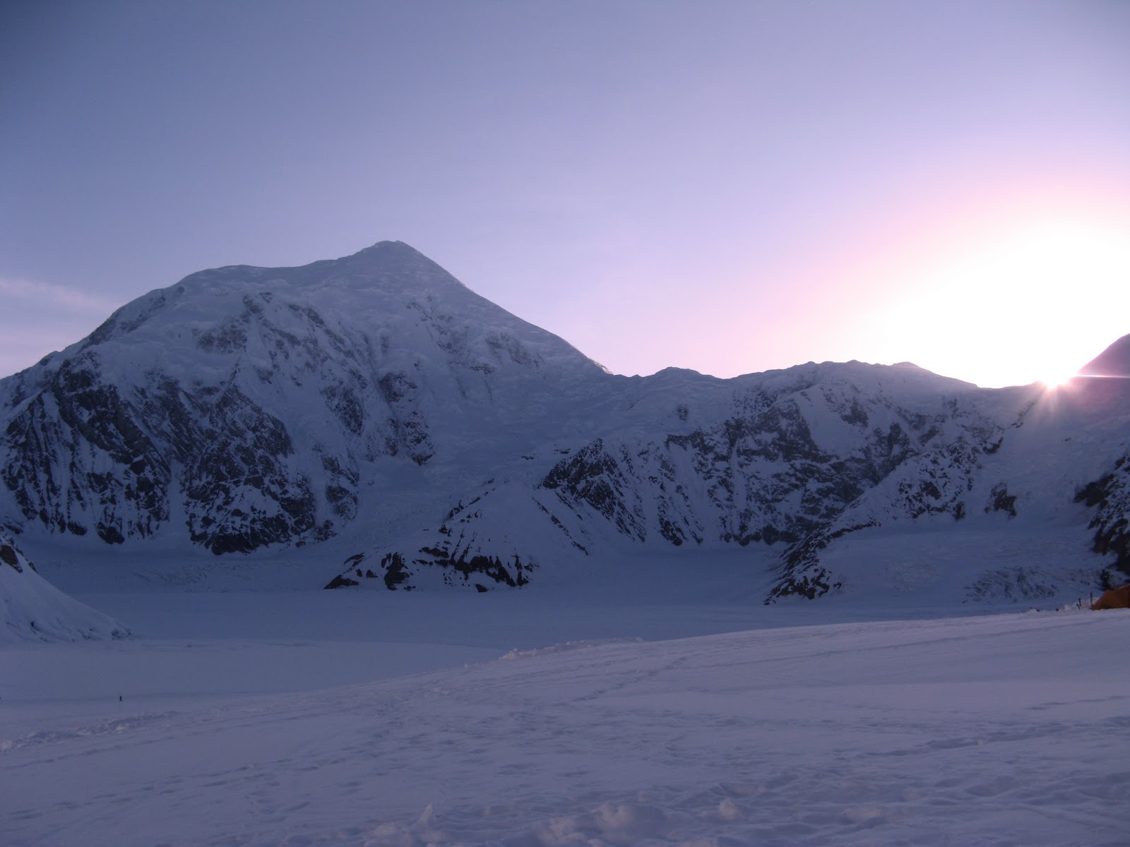
Mt. Crosson (foreground), Peak 12,472 (bump on
the right), Foraker towering behind
It's odd... in the last few days leading up to my departure for the heavily glaciated and shattered flanks of Mt. Foraker, Crosson, and Peak 12,472, I've caught myself absentmindedly reflecting upon the complex web of training, planning, circumstance, drive, and need that has led me to this point. It's as though I'm drawn back to memories of the process subconsciously, automatically--almost inexorably.

Perhaps it's just the final manifestations--the death throes of the near-obsession mentality I've had as my mantra over the course of the past 12 months.

That laser-focus has been a necessary part of the journey, too, to keep me focused on doing what's required day in and day out to be physically and mentally prepared for a climb of this magnitude. But it's as though that deep rumbling in my spirit is finally ready to stop making quakes and at last relinquish my mind to the actual experience, instead of just far-off imaginings of what the reality *might* be.

Day by day, week after week, month after month, I've struggled against gravity in the gym, hurled myself into the street for long runs down neverending dark roads, leapt, pushed, squatted, pulled, grunted, screamed, and sworn my way to the condition in which I now find myself... prepared.

Punctuated by the weekly rituals of long miles in steep upward slogs under outrageous pack weights to the tops of local peaks, I now stand fully ready to perform in the manner of my training, and to now do it in one of the world's most unforgiving and inhospitable environments: the Central Alaska Range.

But here I am, 4 days from embarcation and, like last year, I again find myself put upon by the same strange paradoxical emotions. It's a dizzying cocktail of exhilaration, trepidation, confidence, disbelief, conflict, fear, and certainty that always seems to be fueled by a latent, ill-mannered guest in my head: a quiet but nevertheless nagging worry.

Worry that I didn't train hard enough, didn't practice the right skills, didn't weight my packs heavy enough, didn't train on the right kinds of terrain or with enough variety... but I know in my heart and in my conscious mind during daylight hours that I did all those things--and more.

I'm absolutely ready... but at times like these, I can never quite seem to shake that quiet doubt, as if a slippery worm were turning over and over inside my head, boring tiny pinholes in my otherwise iron resolve. It's fascinating to uncover such strange and conflicting feelings.

A few days ago, I was tooling around on the web looking for climbing statistics for 2010 on both Denali and Foraker, and I was struck by some of the facts I found.

For example, I ran across this image of a 2010 expedition on the Sultana Ridge of Foraker, the same route I will attempt this year. It came from their expedition blog. The weather looks great in the photo, and they definitely found a nice window of opportunity here. As alpine climbers, we all hope for such opportunities, for they often lead to summits.

Interestingly, though, a glance at the stats revealed that just 9 climbers in all of 2010 attempted it, and that a team of 3 climbers were the only ones to summit Foraker via the Sultana Ridge... which tells me this photo may not be that team (because there's a fourth man taking the picture). Glancing through previous years' numbers showed similarly low attempt numbers. By contrast, in 2010, Denali (across the Kahiltna glacier from mighty Foraker) had 1,222 climbers registered to attempt it.

The 2011 Foraker numbers, though, showed just 6 registered! ... and then it hit me: one of those 6 was ME, and the other 5 were the rest of my climbing party. We will have the entire mountain to ourselves. 

The ferocious subarctic weather of the region will determine our every move on the mountain. But while there are other factors that can cause an expedition to fail, if everyone remains healthy and in good spirits, I, too, hope to be approaching the base of the Sultana Ridge in the next few weeks.

But even if waiting out storms and running out of time high on the mountain means "defeat" and turning around without a summit, I have always believed in drinking from any experience as much knowledge and learning as I possibly can. This mountain is beautiful to behold... but she is a rare and fickle creature, and does not allow many to conquer her. With uncooperative weather, there's indeed a good chance I won't summit. She's that kind of mountain; but there is no defeat if you walk away with lessons learned.

See you when I return.

On the summit of the Radio Control Tower - May, 2010. The tail of Mt. Hunter's west ridge
is on the left, Foraker in the distance.


Tuesday, April 19, 2011

Final training for Mt. Foraker -- on Mt. Shasta April 15-17, 2011

Watch for links to video below, and click pics for bigger versions!

What better way to finish up a 6-month training cycle for the biggest climb of one's life than on beautiful Mt. Shasta? That's exactly what I did this past weekend in preparation for my departure next week for three weeks expedition on 17,400-foot Mt. Foraker, 200 miles south of the Arctic Circle, deep in the Alaska Range.

I was excited to spend three days in the backcountry of my official "home mountain", camping, climbing, ski mountaineering and touring, refreshing my crevasse rescue system and ice/snow anchor building skills, and generally doing a dress rehearsal for living for in frigid winter weather.

This time of year falls into an amazing transition Shasta makes between ferocious, unpredictable winter and periodic spring powder dumps of spring, and it seems there's been no shortage of that this year, but

Forecast says rain for the weekend… hmm… bleh. Well, one does what one must… and off I went. I was excited to see the mountain again as I made the 5 hour drive from San Jose. The goal for this trip was to leave early so I'd arrive with plenty of light to get up to Bunny Flat, ski in, and find a good campsite before dark.

I arrived with plenty of light, grabbed a few items at The Fifth Season down in town, and headed up. The higher I went, the foggier it got, however, and as I pulled into the parking lot to prep my gear for the climb in, I was in near-zero visibility fog conditions—and it was drizzling. Yuck.

I changed into mountaineering gear, shouldered my pack (which I'd packed to about 60 lbs, as though this were the real deal on Foraker), slapped skins on my skis, clicked into my bindings, and headed off up the mountain. I climbed about 200-300 vertical feet before I realized just how foggy it was getting… and the dark was coming.

So I found a suitable spot up higher, stomped out a platform for the tent, but then changed my mind and decided to follow my track back down a bit so that my mountain guide could find me more easily tomorrow.

I skied back down a ways, but I struggled to find the track in the fog, and I really couldn't tell much about my heading. So in the gathering rainy gloom, I continued downward, and then decided I must have missed the cutoff to the right, which put me farther below my origin than anticipated.

All that aside, it was time to get camp set, or I'd be doing it in the dark. I found a spot that was protected from the only small avalanche danger I could see near me, stomped out another platform in the deep snow, and as silent darkness enveloped me, I set up camp, got comfy, and cooked dinner. Tasty. I love this.

All bundled up, I was tired from the drive, and soon felt the urge to crash.

It was a rough first night. Rain drummed on my tent on and off through the night, and the transition from comfy bed at home to winter sleeping pads in my tent wasn't a smooth one. I woke up every few hours, checked my watch, tossed a bit, and then finally fell into a deep sleep near 4am.

2 hours later, I woke to crystal clear skies and a beautiful alpenglow dawn breaking over the hills across the flat, and a glance uphill staggered me. The mountain was just coming out of a restless fog, and it was clearing. I grabbed the camera, threw on my down camp booties, and lurched out into the snow to start snapping pictures.

After that, I looked down the hill… and my realized my campsite was the perfect distance from the car, and in an exactly perfect spot, too. AWESOME.

A hearty breakfast of eggs, hash browns, peppers, onions, and sausage, complete with coffee, spiced hot cider, some cocoa rounded out my morning, and I then set about the daily task of melting snow to fill up my water bottles again.

I had originally planned to get out early for a quick skin and ski up the mountain, but I was enjoying the scenery so much, I decided to just wait it out until Dane from Shasta Mountain Guides arrived.

We'd spend the day drilling on crevasse rescue systems, rope skills, glacier travel, anchor building, and other things I'll need to be sharp on when I arrive in AK next week.

He arrived at 9pm sharp, and most of the morning was spent discussing anchors. I then built a good strong one, attached the climbing rope to me and a backpack to the other end, and tossed it over a 15-foot snow cliff to act as the "fallen climber in the crevasse" I'd be rescuing.

That was fun. We built the primary direct haul systems for 3:1 and 5:1 with a couple of variants thrown in for special situations, and then moved on to rope skills discussion and practice.

Then it was on to fixed line ascension and review of technique and options for climbing on running belays, and fixed lines, which we'll probably be using on Foraker to get people up trickier sections. I especially like that we got to spend some time on personal tricks that make life safer or better on any glacier.

Then Dane and I headed uphill to my campsite, where I cooked me some lunch and provided hot water for his afternoon beverages, and then we set out on a ski tour up to about 8k… Horse Camp.

It was an easy climb up the gully leading to the Gulch, Green Butte Ridge running upward on our right, but got a great workout in, and we did it in about an hour, arriving at a COMPLETELY buried lodge (up to it's rootop!) owned by the Sierra Club that's only used for emergencies. Super cool place… stone walls, a huge fireplace, and a classic European feel, and it sits near the base of the spectacular Avalanche Gulch. This is a route I've never done on Shasta so far. I did the North side twice last year, soloing it once, but the South side is much more accessible, and that's the main reason the majority of climbers go up this way.

Anyway, while we were transitioning for the ski back down, the rain picked up a bit… yuck. We waited it out a bit, got the gear dialed, and then took an easy ski back down our skin tracks on manky wet snow. Back at camp, I had a brilliant idea that I could never do on the North side of the mountain, because it's so remote: drop the gear and head into town with Dane for burgers! That was a good idea.

After a BBQ chipotle bacon burger (whoa!) at the Wayside, I thanked him for his time and expertise—it was super valuable to me—and then I headed back up to my little campsite.

I vowed that if it were raining when I woke the next morning (I'd checked the forecast in town… more rain predicted in the morning and afternoon), that I'd pack up camp first thing and head back home. Why? Climbing in the rain totally sucks, and when you don't even HAVE to, it's especially miserable.

Sleep came easy Saturday night. I'd had a good workout and a huge gut-bomb of a meal, complete with sweet potato fries, so I pretty much passed out and slept warm. Again, though, every few hours I'd toss a bit, check my watch, and go back to sleep, again finding my sleep rhythm near the morning hours.

I overslept Sunday morning, so I missed the early dawn light, but caught some fantastic pictures in completely clear weather! I was stunned and excited to have a window of opportunity to climb again, so after a hasty breakfast of gross oatmeal, good coffee, and more hot beverages, I threw on my climbing gear again, packed up my camp entirely, and back up the hill I went under near-full weight..

Instead of bearing left to the lodge at Horse Camp this time, I hung right a bit, skinning along a line of trees on the upper slop of the approach gully, grunted up the last few hundred vertical feet to a flat area at about treeline with a spectacular view of just about EVERYTHING, and shot a bunch of pics.

I was satisfied, and with my mission accomplished, I stood about halfway up Shasta's mighty flanks, and knew it was time to go home. The difference, however, is that today's uphill pack was fully loaded, so the ski down was quite a bit harder than the day before. My quads were burning by the halfway down mark.

But it was a quicker ski down, nevertheless… and all the way to the car this time, too. I sorted gear in the parking lot for a bit and waffled about whether I should cook a meal here before I headed back home, thought better of it, and loaded up for a bailout.

 On the way home, I noticed I'd taken 344 pictures. Whoa. HAHA


Monday, February 7, 2011

My first backcountry ski tour - North Fork Wilderness, Big Cottonwood Canyon, Utah

Watch for links to video below, and click the pics for larger versions!!

Well... it was time once more for ANGST (the Annual Naked Guy's Ski Trip haha) in Utah. This year was to be Park City... 4 days of bliss in feathery Utah pow, but after having done a backcountry ski training course this past weekend at Alpine Meadows in Tahoe with the ever-cool Rich Meyer (my guide the first time I went up Shasta last year), I decided to fly in a few days early to put my newfound skills to the test.

With a huge dump of fresh powder in the night, my original plan was actually to just head up Big Cottonwood Canyon to Solitude and resort-ski my ass off while maybe diving off into a bit of the sidecountry. But on the way there, I spotted the most beautiful lines in high, uncut snowfields, accessed by up a steep drainage in the North Fork trail direction.

I simply couldn't resist the call of it. In a split-second, I'd made the decision to stop, pulled off to the side of the road, parked the car at the trailhead, and unloaded my crap.

It didn't take me too long to get the skins on my skis and out onto the track, and along the way, I made a few carefully planned switchbacks that gave me the opportunity to practice my kick turns, and kept a good, steady, efficient grade up the mountain.

About 500 vertical feet up the first hill I paused for a minute, because I heard a helicopter coming in. Sure 'nuff... below was a heli rescue happening, apparently for somebody at the nordic center. Can you get injured cross country skiing? Maybe somebody had a heart attack or something. I dunno... Bizarro... Anyway,

I continued upward, and every minute I climbed higher gave me ever more spectacular views. It was such a perfect day... sunny but cold, and the snow conditions were perfect. the scenery got more spectacular by the minute.

It was a perfect sunny day, snow conditions were good, . And Higher and higher I went, marveling at my good fortune. THIS is why I do what I do... those perfect solitary moments of quiet calm, of absolute alone-ness... I had the entire mountainside to myself, and I couldn't believe people were passing this by.

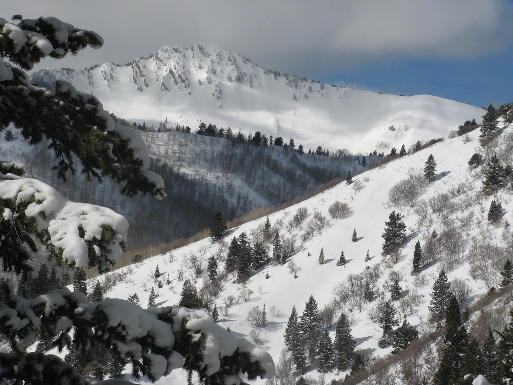
I had set a time limit for myself of a few hours just sorta cruising around up in the area to see what I could see and get some good practice in before heading back down, and I definitely found what I needed. Pure perfection, in a single photograph:


I think I'd have just about killed for an ultrawide or a 180-degree fisheye to capture even more of that scene. The clouds were perfect, the day was bright, and the conditions were pristine, but the deep powder below me beckoned as the sun waxed high.

Amply satisfied, I decided to find myself a place to transition from climbing to skiing and head back down to the car. Due to some poor planning of my upward line, I got a little bit hung up in some trees near the top of my route for the day, so I had to kinda work my way out of that mess and traverse back over into the clean downhill line I'd spotted far below and hours earlier.

I finally made my way out, found a good spot to transition, and made the switch. As I took one last glimpse of the perfect beauty that surrounded me, I shook my head in disbelief. "Imagine what I could see if I actually PLANNED to be here," I thought to myself.

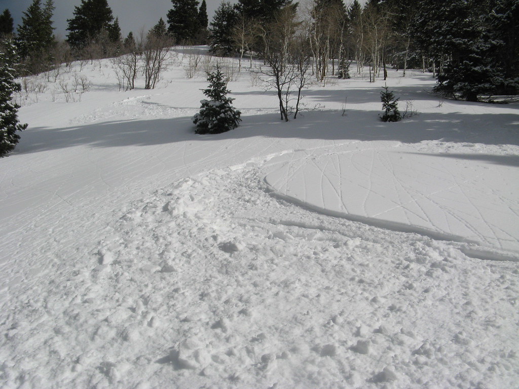
And then I hurled myself down the hill in fresh, chest deep Utah fluff. WOW. Hard to beat a perfect line in perfect snow on a such a heartbreakingly perfect day. 


Tuesday, December 7, 2010

More photos from Alaska - May, 2010

Jason Thompson, our lead guide for the AK seminar this past May, created some short films about the course, starring... US! Haha I saw him off in the distance filming a few times, and always wondered what some of those images looked like... so I took some of the video and created stills from it. They turned out pretty cool. He's a good photographer/videographer! :-)

(I'm the one in the red jacket in all of them.)


Heading up the glacier to Mt. Frances Basin - Kahiltna Queen in the left background, North Buttress of Mt. Hunter on the right.


Dropping down into a giant crevasse during rescue training

Moving up the glacier to the Mt. Frances basin - The Kahiltna Queen in the left background, North Buttress of Mt. Hunter behind me

High fives on the summit of Mt. Frances, after successfully climbing the East Ridge.


On the summit of Mt. Frances. The stunning Kahiltna Queen is in the background, wrapped in a cloak of cloud.


Tuesday, November 23, 2010

A couple more pics from Mt. Superior

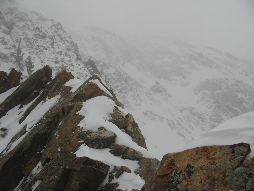
This is what it looked like near our top-out point on Mt. Superior just before we turned around. Tyson took this pic of me crossing some steep slabby stuff  (with pretty serious exposure) that led to the decision point.

Near the turnaround point in 40+ mph winds.

Monday, November 22, 2010

Stormed off of Mt. Superior, Utah - Nov 20, 2010

Watch for links to video below, and click the pics for larger versions.

At 5:13 in the morning, anything is possible (except, perhaps, finding an open breakfast spot). That's probably why I imagined myself standing on top of Mt. Superior this morning when I woke up. The flight here yesterday had been uneventful (and catastrophically boring), but now it was time to get up and get moving for the climb.


After a wildly unsatisfactory McDonald's stop (and a 7-11 run, where I found The Holy Grail Of Hostess Products, I pulled into the Park N' Ride parking lot at the mouth of Big Cottonwood Canyon, where I was to meet up with Tyson Bradley--our guide from Utah Mountain Adventures--and Norm, my fellow climber for this trip. We ran over a few details about the climb, piled into Tyson's car, and set out for Little Cottonwood Canyon a few miles south.
The roads were in good shape, and we had no difficulty getting to the base of the route, where we checked snow conditions with our feet to determine whether we needed to bring the extra weight and bulk of the "slowshoes".

We had some discussion of the expected weather, and Tyson solicited the thoughts of the climbing party on which route to take. The original plan, of course, was to go up the more technical south ridge as a mixed snow and rock climb; then walk off the summit down the more gentle east ridge, heading toward Alta before glissading down one of the south face snowfields on what he thought would likely be stable snow.

The dilemma was threefold: Do we do the south ridge as planned, with the winds on the mountain predicted to be high, and a storm front moving in? Or do we choose the east ridge as our ascent route to give ourselves a better chance of summiting in what was shaping up to be bad weather? Or do we wait until after the storm tomorrow and try again?

Waiting would have been a good option, but with heavy snowfall in Saturday night's forecast, the whole area would become one great big avalanche hazard. Ultimately, we decided to attempt the original plan, and decided in advance we'd turn back if it got just too sketchy high on the mountain.

We parked the car, piled out, and threw on our packs. Mine weighed in at around 30-ish lbs... probably (once again) too heavy, but experiences like this are all part of working on my methods for paring the weight down.

It's weird... It's sort of somewhere between an art and a science, knowing how much crap to take with you in your pack. The decisions for me to take some of the extras often come down to those items that might help me cope in a wider variety of scenarios, but I'm finding that usually, that extra stuff isn't worth carrying. The reason is that under most circumstances, you'll never need it, and the idea is to plan your trips and act in a way that helps ensure you wont... meaning climbing safely.

I'm a safety boy, and my Boy Scout dad taught me well to be prepared... so from that perspective, it's sorta tough for me to leave those things behind sometimes... and I almost ALWAYS either overpack or underpack on food, which is kinda weird, too. But I'm doing better. (Plus, it's helping to have Foraker on my list as a goal to start keeping my pack weights as lean as possible. Alaska is much less forgiving... and it's a great lesson for any outdoor activity that involves carrying crap on your back, too.)

ANYWAY... with our hardshells and an extra insulating layer underneath our packs, we were prepared for what was forecast to be some potentially wicked weather up on the mountain. Snowshoes reluctantly in hand, we tromped up the road about a quarter mile to the base of the route, which begins at the bottom of an avalanche runout zone from high off Mt. Superior.

Side note: Apparently, avalanches from Superior run out far enough down the lower apron of the mountain (and beyond) every year to completely block the road, which is why they built a second bypass road that splits off from the main road and goes to the other side of the canyon. When the mountain avalanches the main road, traffic just gets redirected. Interesting.

We crossed the main road northward, and talked as the wind started to kick up. We strapped on our snowshoes and began picking our way through the gaps in a broad swath of bushes that protected the base of the mountain, and headed up the broad, rolling apron, aiming left toward a large triangular outcropping of rock.

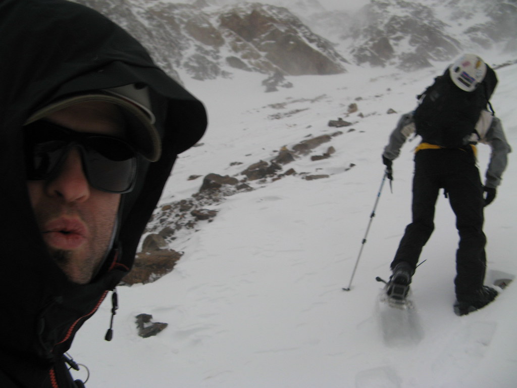
The wind seemed to be aware of our presence, and it howled its raging disapproval, periodically throwing huge, swirling clouds of airborne ice at our backs, and stinging our faces with needlepoints of pain and cold.

The gusts were so sometimes so strong that the best we could do was turn our back to it, hide inside our hoods, cover our faces with globed hands, and crouch or kneel to lower our center of gravity to prevent us from being swept completely off balance. Up over the apron we went, with the wind finding any patch of exposed flesh, the tiniest clothing gap, and occasionally punishing me for looking back over my shoulder at just the wrong moment for Norm, as if delivering a swift retribution for daring to lift my head.

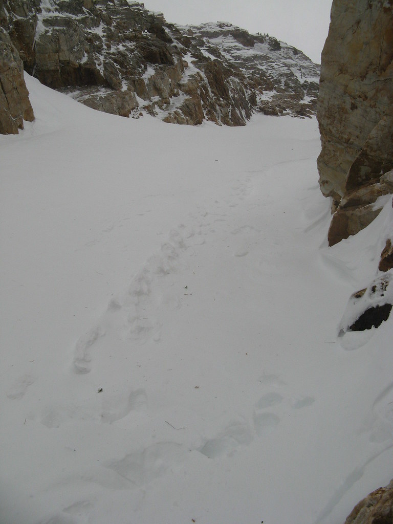
At the outcrop, we did a quick transition from snowshoes to crampons and continued up through the entrance to a steep, narrow couloir--the Suicide Chute, it's called. The entrance to the chute is guarded by huge standing angular rocks--like hungry lions guarding the entrance to a sacred place.

Once inside, towering rock walls rose steep and high on both sides, creating a deep, narrow, snow-filled channel that runs all the way from the bottom of the mountain up to a col at about 9,800 feet, no wider than probably 30 or 40 feet at any point.

The wind continued to worsen as we climbed, accelerating in ferocity, no doubt exacerbated by the presence of the steep, confined rock walls of the chute within which we climbed upward. As the wind came in from the east, it hit the mountain, and swirled violently in angry eddies upward through the lower portions of the chute, pummeling us with gale force.

And every time it came, it pelted us with massive swarms of BB-sized, sugary ice and snow crystals, flung at us with all its might as it blew up the hill. (The noise of this inside a hardshell hood is really loud! Hahaha)

When possible, I would try to take advantage of Mother Nature's wrath, using her gigantic uphill gusts to propel me straight up the fall line in quick climbing spurts instead of the energy-saving traverses most often used. She literally pushed me up the steep slope in places—fun.

The path up the center of this narrow canyon rose sharply above us in a dramatic left-bearing direction around the huge rock buttress created by the south ridge, and as I clambered up over a few patches of rock and ice, my spikes thudded and squeaked as they bit in for purchase.

We continued upward, thinking we'd eventually get into a protected area away from the wind for more stable climbing, and after a break, that's exactly what happened. We walked around a huge corner of rock and stepped into complete calm— a windless, serene, and almost ethereal space in this dramatic snakelike couloir.

As a dull gunmetal dawn broke around us, we could hear the now-feckless wind screaming its anger below us, as though it had lost its favorite toy (us) somewhere in the fray--and it wasn't happy about it. Frantically, angrily it hunted us, but to no avail.

The calm that enveloped us was a welcome break that allowed us to do some focused snow climbing, broken only by areas of near- fruitless struggling through thigh-deep sugar-snow that ran like sand around our feet. As we flailed one step back for every two forward, the mini avalanche rivulets we created ran between our legs and ankles, down the slopes below, as new spindrift poured off the couloir walls above our heads to replace it.

Far above us, the col on the south ridge slowly came into view, and we decided to take our next break in the still-protected section just below it. Once there, we stomped out a small platform, got into harnesses, and roped up for the next section of climbing, which was now transitioning to a steep rock ridgeline.

The wind now blasting over the col above our heads was a completely different animal than the seemingly sentient, salivating, screaming-adolescent banshee of a creature we'd encountered below. Above the calm of our canyon, this animal made a vast, booming sound, a growling, freight-train-like low-frequency roar that blasted an ancient and unrelenting rage against anything unfortunate enough to be on that ridge with it.

We discussed our next steps, and decided it was at least worth a look up there to see just how bad it was—even if it was overly optimistic—so with Tyson leading our rope team, me seconding, and Norm behind, we ascended up and out of our quiet little chute and into the maelstrom.

The sound of it was deafening, and utterly unlike anything I've ever heard before. It battered us and ripped all spoken communications from our throats, hurling them to their wordy deaths down the steep, jagged face of rock and ice on the west face far below.

The plan was that Tyson would set up a series of running belays: he'd place the protection in cracks and around protruding points of rock, and then clip the rope he was trailing through it. He'd then climb until I reached it in the middle of the rope at my harness, and then wait until I'd clipped around it before continuing.

So immediately off the col, we turned sharply right and began climbing a steep right-slanting series of cracks and ledges. About halfway up this section, the wind finally began to drill through my warmer gloves, and my hands and fingertips began to get very cold indeed. A quick bout of arm-swinging cured that problem, however, and I continued—up and to the right, baby… up and to the right.

I, as the second of our three man rope team would clip around the placements as I came to them, first clipping the back strand of rope before unclipping the forward strand from my link to the protection Tyson had placed above. And Norm, a rock climber with limited leading experience, brought up the rear as he removed and collected the anchor hardware.

The immediacy and angle of the rock ascent straight out of the chute took me a little bit by surprise, but I soon had the cautious hang of it, and I got a better feel for what I was doing quickly. That said, footholds and handholds in gloves, crampons and several insulating layers plus a weighted pack are quite a different matter than rock slippers on a sunny, warm day in shorts at the crag.

Neverthess, it was clear that I need and would benefit greatly from more exposure to this kind of climbing in addition to time on the crags. Learning to be a little more efficient in my movements will be a key element of my success in the mountains, I think.

And yet THIS is what I longed for… doing it all in heavy gear, challenging my senses to stay foused, to feel what my hands are doing in relation to their purchase on the holds, with a layer of glove between skin and stone.

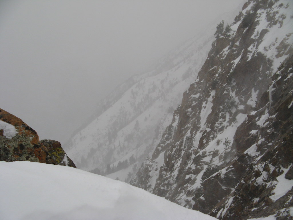
Certainly, the sensation of "airyness" as put forth in the climb description—that sense of very steep cliff walls falling away into thin air with long drops beneath your feet, the feeling that a slip might result in a midair dangler—was quite accurate. And though we'd not yet even ascended to the point on that knife-edge ridge where we were under hazard of the most significant exposure along this route, it was an exhilarating feeling to be there… really DOING it.

Once through the first rock portion, we stepped and climbed around a jutting corner of rock that took us out onto a short, steep slabby section of less featured stone that dropped sharply down and to the right into another steep couloir below—with far fewer good holds for hands and feet on it.

I was able to use the frontpoints of my crampons fairly well through this section, however, by jabbing them into stable cracks between solid pieces of stone. Tyson was waiting at the top and providing some feedback on the moves (and a belay), so that was helpful, and I got across it without too much trouble.

Once across, I stepped back onto the steep snow slope that led up to Tyson's position above, and up I went. As I waited for Norm to come up behind, I checked the altimeter: 10,242 feet: 800-ish vertical feet below the summit.

At Tyson's lofty perch on a ledge of the rocky ridge we'd just climbed, he called a pow wow to discuss whether we should continue. Tyson knows this route well and understands what's to come, so he laid it out for us, along with his recommendations. That the forecast for high winds was "verifying" was an inescapable reality. And based on his thoughts, the question of whether we should continue seemed only to be a question in the academic sense at this point. Nevertheless, it was a good discussion.

In our guts, Norm and I, I think, already knew the answer: time to turn back—unacceptable risk ahead. Tyson agreed. Furthermore, in his much more objective and expert opinion, retreat from the point at which we stood becomes increasingly more difficult should the wind outmatch us higher on the mountain. There was also the fact that in the face of 60 MPH gusting winds where we were, rock climbing crux moves of 5.6 at higher elevations become a lot tougher than 5.6.

More important, however, was his concern that should one of us be hit by such a gust in the middle of a delicate rock move in one of the exposed sections of ridge above us, the situation could become an epic in a hurry. None of us wanted that, so he suggested our summit dreams were likely dead. Though disappointing, Norm and I agreed and sounded the retreat.

But even unsuccessful, the ascent was not for naught. Tyson transferred part of his rack to Norm, who led on the way back down. Norm got some practice placing protection, and Tyson evaluated his placements as he removed them on his way down and gave Norm feedback on their quality.

The downclimbing was fun, and I was able to move a little faster this time, just because I'd grown a little more accustomed to the activity. Focus still paramount, we moved back down off the small sideways slabby rock section, back around the rock corner, downward and leftward into the lofty vertical-ish ledgy stuff, dropped back onto the narrow col above the Suicide Chute, and descended back into… a deafening calm of windless peace once more.

As the brash and bellowing freight train wind above us thundered its baritone discontent and lashed the trees on the ridge, Tyson conducted a mini clinic on placing protection with active cams and nuts, and Norm set up an equalized 3-point anchor system for practice.

We all munched some food, had some water, unroped, and began the glissade down the chute, back into the waiting jaws of other reproachful, more high-toned winds far below.

With relatively stable snow conditions today and some avalanche education from Tyson (but keeping a mindful eye on the possibility of avalanche in the chute), we lost altitude quickly with a combination of buttslides and plunge steps. We treated this descent as a backcountry ski descent: one at a time, waiting in avalanche-safe areas below and leapfrogging each other as we went.

The flying torrents of spindrift became so ferocious near the bottom of the chute that my glasses completely froze up at one point and a tiny patch of exposed skin on my forehead between my hat and glasses began to ache from the violent and repeated ice crystal sandblasts.

For a minute or two, I could see nothing of one glissade stretch. Luckily, I was in the middle of a pretty straightforward and controlled slide when it happened, so no harm done. We all switched to goggles just before the couloir spat us back out onto the upper apron once more. It seemed to me as though the rock sentinels guarding the entrance to the Suicide Chute glared at us as we passed between them, bludgeoning our way through thigh-deep posthole snow.

Eventually, Norm and Tyson go frustrated with the hard work of breaking through the crusty snow and switched back to snowshoes, but I figured by the time I got mine on, I could be nearly halfway back to the road if I really kicked it in the ass. And, I reasoned, I could burn a lot more calories struggling in the snow than floating over it, thus making up for some of the lost effort we'd missed out on by not finishing the last 800-1000 vertical feet of climb to the summit.

Ordinarily, I'd never do that, simply because struggling in the snow is a huge energy sink, but once on descent of the upper apron out of the col, a safe return was pretty much assured, so I worked hard on purpose :-) It was fun!

Discomfort is a way of life in the high mountains, and disappointment is sometimes not far behind, so I'd say I learned many valuable lessons today, both physical and mental. And though I am indeed disappointed that I failed on Mt. Superior (this time), it helps me understand more about myself and how I'll handle that disappointment on larger objectives. It's certainly a good possibility on Foraker, a mountain with a mere 30% summit success rate.

But I'll be back another day for another attempt on Madame Superior. The prospects of going to the top by that route are exciting indeed, and I've only just had a taste.

Monday, November 8, 2010

I've got one more climb in me for 2010!

Just booked an alpine-style trip with Utah Mountain Adventures (formerly Exum Utah, apparently) up Mt. Superior (11,050 ft) in Utah. The base of the climb starts right across the road from Snowbird in Little Cottonwood Canyon, as it turns out, and heads up a formation called Suicide Chute... cool!

Being that I grew up in the Salt Lake area, I've hiked, camped and backpacked quite a lot all over the place out there, but never delved into the myriad mountaineering challenges that exist practically everywhere. That makes me super exited to log my first alpine-style mountaineering trip in the Wasatch Rockies and bag a summit I've never been on in the process. STOKED!
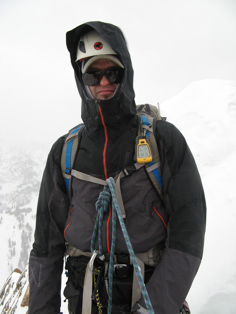
It also presents an interesting opportunity to get some winter camping practice in for Mt. Foraker (pic at right) in April 2011, as well. I got thinking... instead of booking a hotel in the Salt Lake valley somewhere, I'd maybe just pack up the Trango 2, the winter sleeping bag, stove, and a bunch of food and just... pitch a camp right next to the start of the climb on the 19th! Why not, right?
That way, I'll be there bright and early for a quasi-alpine start the morning of the Superior climb on the 20th, and I'll be able to crash out there for the night--AND do some more climbing in the morning and day of the 21st before I have to break camp and head back to the airport.

Pondering...