Watch for links to video, and click pics for larger versions.
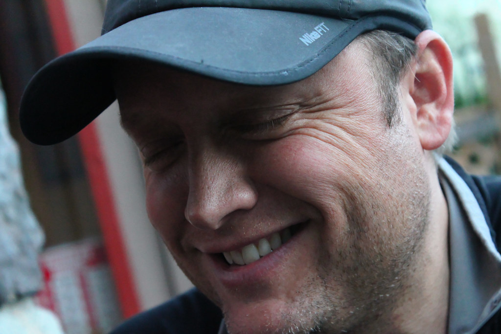
My mountain guide mentor / friend
Rich Meyer hit me few months ago with a wicked post about Matterhorn Peak in the Sawtooth Range, just outside Yosemite. I think he must know me well enough by now to know that I'm a total sucker for descriptions of awesomeness... and especially descriptions of LOCAL awesomeness like this place. Whooooo! I decided that was my next big mission without even a thought.
So with a bit of information in hand from the internet, and visions of justifiable awesomeness in my head, I proposed the idea of doing an early April ascent to my climbing buddies Dan (Seattle) and Denis (Quebec).
Like me, they were immediately stoked on the idea, too, and the answer, as I expected it would be, was an immediate and resounding hell yes.
We set dates for a Thursday-Sunday (but unfortunately lost Denis as a climbing companion for this trip along the way, because he was putting on HIS first mountain guiding service expedition a week or two before and couldn't get away... a trip to the Torngat Mountains in Northeastern Canada--go Denis!)
 |
| In the lovely Mono Village RV park. |
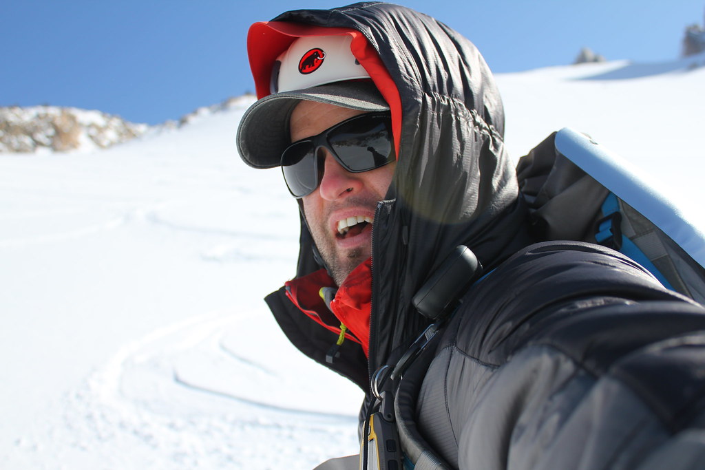
Undaunted, Dan and I moved forward with the plan, an easy 3-day climb and ski of this 12k+ foot glaciated beauty. We started from San Jose early and made the 6.5 hour drive to Twin Lakes in good time, immediately upon arrival, we were stumped by the rannnndommmm parking situation--and the complete lack of people around to ask about it.
There's no friggin parking along the road leading up to the RV park! Well, unless we wanted to risk getting towed while we were on the mountain, and come back weary to... no transportation outta there.
So we ended up dropping all our gear at the entrance to the Mono Village RV Park, I put on some walking shoes, drove back up the road a mile and a half to a spot where I could park safely--and then walked all the way back to the gear.
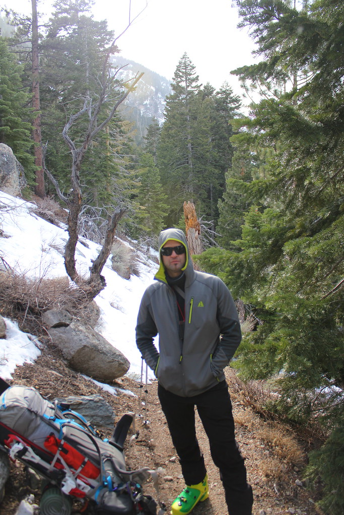
 |
| ONWARD! |
I camouflaged my walking shoes up on the hillside with some rocks and pinecones, and then changed into my AT boots, and we finally got going with full packs.
The Mono Village RV Park is sorta surrounded and crisscrossed by tributaries of Horse Creek, which runs out the bottom of our goal canyon across the valley from where we parked, so you'd think because of the length of the park, there would be multiple crossings.
But... uhhh.... no. Right away, all our logical paths to the trailhead were blocked by water and crazy logfall jumbles and sandy riverbanks and lakes. Weird.
Dan and I commented later that whenever we climb together, we always seem to get hung up by sketchy river crossings, like the time Dan
fell in the Merced River in Yosemite a couple years back--or the reallllllly wide crossing where he
just about broke his ankle in the middle of the descent from Baker last year. What the hell...?
 |
| Dan, not falling in a river. |
Anyway, we kept on fumbling around (with copious amounts of swearing, I might add) and eventually found the solitary bridge crossing at the far end of the park, which THANK GOD I marked as a waypoint on the GPS after we'd crossed it to the other side.
 |
| On approach |
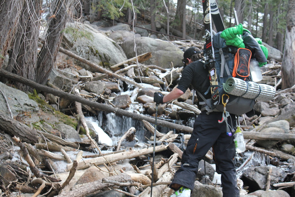
From there, we found the trailhead without difficulty, and started up. There was still a fair amount of snow in places across the trail, so it would drift in and out, and sometimes we'd be walking in mud or on snow and ice for a while, but eventually (and inexplicably--probably because we were SOOO STOKED to get to some legit snow and get on our skis to make upward travel easier), we unwittingly violated the numero uno rule of not just climbing approaches but even tourist day hikes: stay on the fucking trail. Uhhh... oops.
We got to a place where it looked like there was pretty consistent and wide open snow above us, so we strapped on our sticks and started climbing on snow... which immediately resulted in a long and very difficult bushwhacking session through all manner of undergrowth, trees, bushes, and various kinds of crappy terrain.
We'd take off the skis to get through certain sections, and we'd posthole up to our knees and break through moats here and there... that was some hard going, I gotta say.
Took up more time than we wanted, too. By the time we crested our first major hill, we'd only covered about 1,000 vertical feet, it was starting to snow, the temp had plummeted, and we were losing our light. ARG.
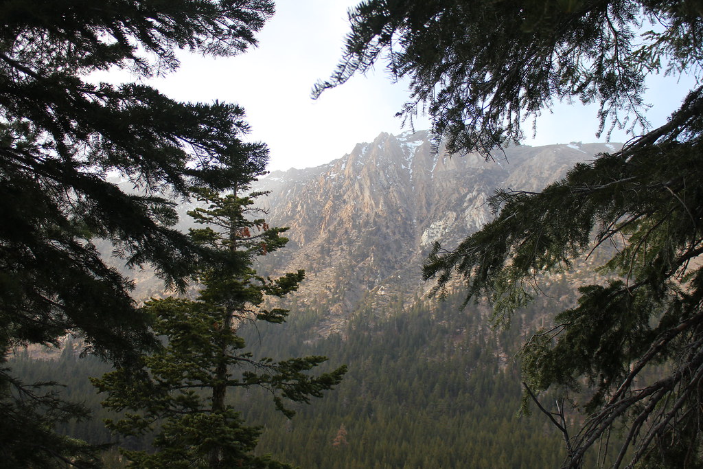
 |
| The view across the canyon from down low |
On the bright side, the way we'd planned this trip was for a leisurely ascent, with plenty of time built in for things to go wrong, for weather, for proper rest, and more--and we were already a full day ahead of schedule being even this high up in the canyon anyway, since we hadn't realllllly planned on climbing on Thursday anyway.
Plus, oddly, Dan's feet were really killing him in the boots he'd chosen for this trip. We weren't really sure why, but for me, stopping where we stood was no problem... after the heavy bushwhacking, we were tired, so we dropped camp in what would probably be lake area if it were spring runoff time, and found ourselves a nice spot on a meager foot of snow (haha) as the precip began to fall in earnest.
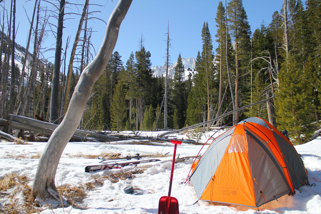
 |
| Our beautiful (if snowless) camp 1 |
That got us moving... packs open with snow falling out of the sky is a good motivator, so we popped the tent, chucked our crap in it, and climbed in to start melting snow for water and cook dinner as the temps continued to drop. Yeah... it was gettin collllld.
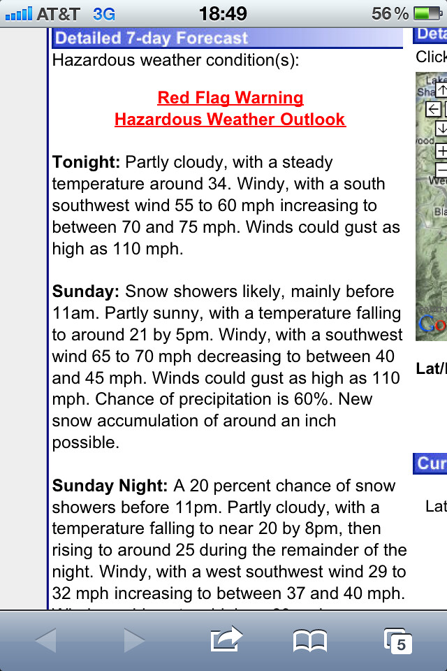
The forecast said Thursday night was to be the coldest of the three by far (which didn't exactly turn out to be true... all were colllllld), which in and of itself isn't a bad thing... it's just that my main concern was that I'd chosen to bring my Western Mountaineering 30-degree sleeping bag that packs down to the size of a cantaloupe and weighs a meager 1.5 lbs, and I wondered whether I'd be warm enough on Thursday.
As a precaution, I'd also brought along a second sleeping bag: this one, a lightweight summer bag rated to 45 degrees, just in case. And anyway, both of them together still don't take up as much pack space or weigh as much as my only other sleeping bag, my giant, poofy -20 degree, 4lb sucker I take to Alaska. But I was concerned, nevertheless. (Turns out I never needed the second bag.)
So after dinner, I sent Dan out with a suitable bag to gather snow for turning into water for the next day's climb, and we spent some time melting that snow for water and filling our water bottles with hot water--hard to beat for warm sleeping bags in the night.
Yeah... pretty mundane. Except for the fact that literally the INSTANT we were done and I'd shut off the stove, I realized something.
Me: OMG, WE'RE DUMB!
Dan: Whu?? Why?
Me: HOLY SHIT, WE ARE DUMMMMMBBBB!!!!
Dan: Why are we dumb?
Me: Oh, only because there's been a fucking STREAM OF CREEK WATER running right past our camp this entire time, and we didn't need to: #1 pack the extra fuel to melt all this snow, and #2 waste it cooking the water for so long... because the stuff in the creek is already melted! ARRRRG!!
Dan: WE ARE DUMB!
Me: OMG... DUMB!
To be fair, I'm not sure we could have known, given the nature of our climbing day, that we'd be camped so close to running water that night. We thought we were going to camp much higher, where there actually IS no accessible runoff, sooooo... I think we packed right, but still... hahahaha DUMB!
Aaaaanyway... the night got calmer, the snow stopped falling, it got black, then blisteringly cold, and crystal clear outside the tent, and finally, a fat, bright full moon came up. Gorgeous.
 |
| Cleaning up and getting ready to leave Camp 1 |
When we woke the next morning, we took it slow and lazy... because being ahead of schedule gave us the relaxation and slack time to cook a leisurely breakfast, so we talked a bit about our plan for moving up to our originally planned high campsite. Eventually, we got it figured out and packed up.
We broke camp around 11am and moved out and upward, thinking that we'd eventually hit the huge flat area shown on the topo... but hugging the trail on the left side of the canyon and traversing across the hill on a pre-existing track didn't really reveal it until we got sick of the sidehilling some dude before us had chosen as his path, left the skintrack, and skied across and downslope a bit through the woods... and at LAST, the huge upper Horse Creek drainage spread out wide before us.
We'd only been climbing for an hour or so, but by now, Dan's feet were unfortunately really giving him trouble, and he needed a break in the trees to take care of them. Man, foot trouble SUCKS on a trip like this. Completely unforgiving.
While we chilled out, we
walked out into the huge flat to scout the route ahead, and see if we could identify some of the peaks and terrain features around that we'd read about in other people's trip reports and pics.
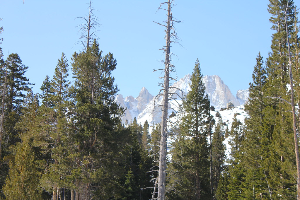
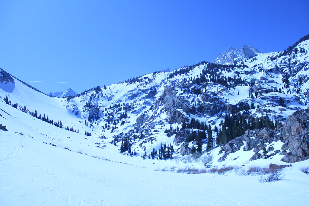
 |
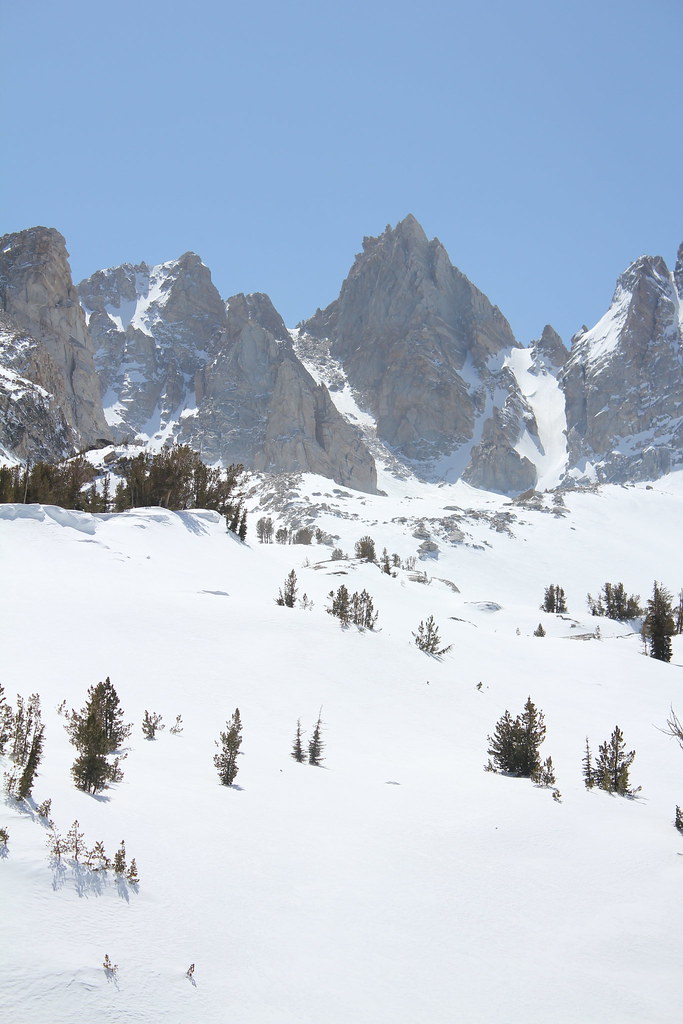
| Looking up at the goal from what would become Camp 2 |
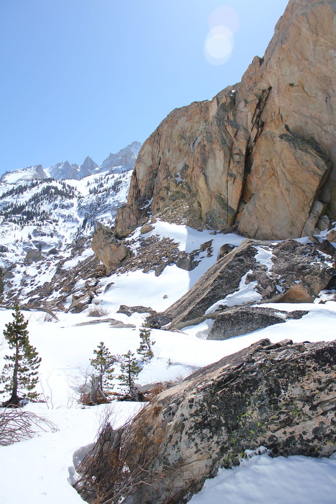
After a long, mild uphill grade, followed by a slightly less mild uphill grade and another 30 minutes or so of climbing, we pulled around the corner of a HUGE granite buttress on the right. It was a beautiful spot. Building-sized boulders jumbled in a heap at the base, and Horse Creek wound and gurgled its way through them in a beautiful, twisting line.
Finally before us far ahead shone the Hourglass Headwall, a steep, broad face of glistening snow without a trace of anyone's passage. That way, it seemed, was the way up, but from the top of the Headwall, it was unclear from our current vantage point where the route lay. But it didn't matter right now anyway, because the pain of boots-chosen-too-small was killing Dan, so I suggested we drop another camp here and
get off his feet.
We picked a KILLER spot to camp on very deep snow (and tested to make sure we weren't camped on a creekbed snow bridge that might break and plunge us into freezing water in the night haha) with easy access to Horse Creek for water, and sweeping views of the entire surrounding lower Matterhorn Peak amphitheater. Narrow cliff-lined chutes, tight couloirs, giant boulders and big terrain features boiled and churned off the mountainside, all the way to the base of the headwall from an adjacent slope to climber's right, and it all combined to make one of the most spectacular scenes I've seen in a while.
Yesterday and today, we'd leapfrogged 2 people--a couple--on the mountain back and forth a few times. Today, 2 others cruised past us after we'd set camp again, and we said hello, asked whether they'd been up there before, and generally got some intel on the climb ahead.
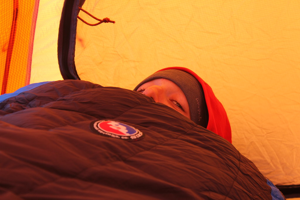
 |
| Dan, groundhoggin it. |
The news was that the upper cirque at the base of the peak was still 4-6 hours of climbing away (depending on strength and speed), so we chewed on that for the rest of the day while we discussed options.
We were already prepared for 3 nights on the mountain, but short of Dan's boots sudden;y becoming a perfect fit and his feet making a miraculous recovery overnight, it seemed silly to stay tomorrow night, too.
We decided we'd make a gametime decision in the morning, so after another big dinner, we hit the hay with more hot water in our bottles.
 |
| Swearing at my Spot device. WORK! |
The night got super windy... big gusts came howling up the canyon and battered our tent, and by morning, it hadn't really abated much---but a little. I'd rather climb in some wind than not at all, so again, we did a health check to see what our options were on the day. We talked through breakfast, again weighing our options.
With a note of disappointment in his voice, Dan's vote was to go down today, which I agreed would be best for his feet for sure. Assuming we decided to go higher instead, his feet would only get worse, and we might only get a good hour or so of climbing in before needing to turn back anyway.
But then I started thinking... we'd already put in the work to come this far, and it's not
often you get scenery and solitude like this, so we may as well relax, chill out, enjoy what we'd gotten so far, and stay the
third night as originally planned.
Then around 10:15am, another idea hit me.
 |
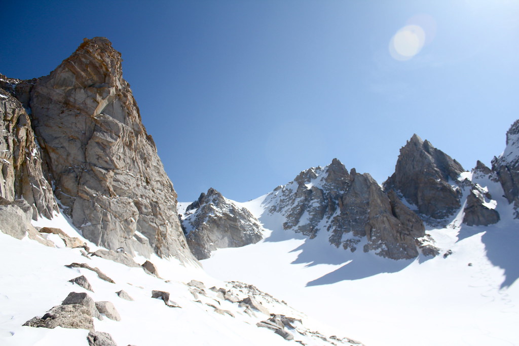
| The Hourglass Headwall is the face on the distant left. |
"So, I just had another idea: what if I were to go up on my own today and see how high I can get? You'd just have to wait here in camp all day... would that bore you silly, or is that ok? Standing where we are right now just makes me wanna get up this thing even worse, and I'm feeling strong with no issues... you mind if I get up there?"
Dan was totally cool with that, so 15 minutes later, I was out on my skins, pushing up toward the first big barrier between me and the top: the Hourglass Headwall. Earlier that morning, the wind had obliterated the skin track from the couple that had leapfrogged us late last night on the way up to their high campsite, but I'd studied it well last night, and knew what I needed to do.
As I approached the headwall, I planned my line, and 9 or 10 switchbacks later, I
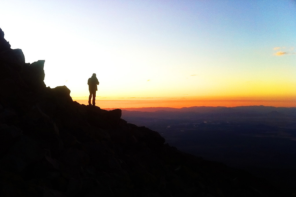
topped out for a break, looking down on the tiny orange dot of our tent in the far distant below.
 |
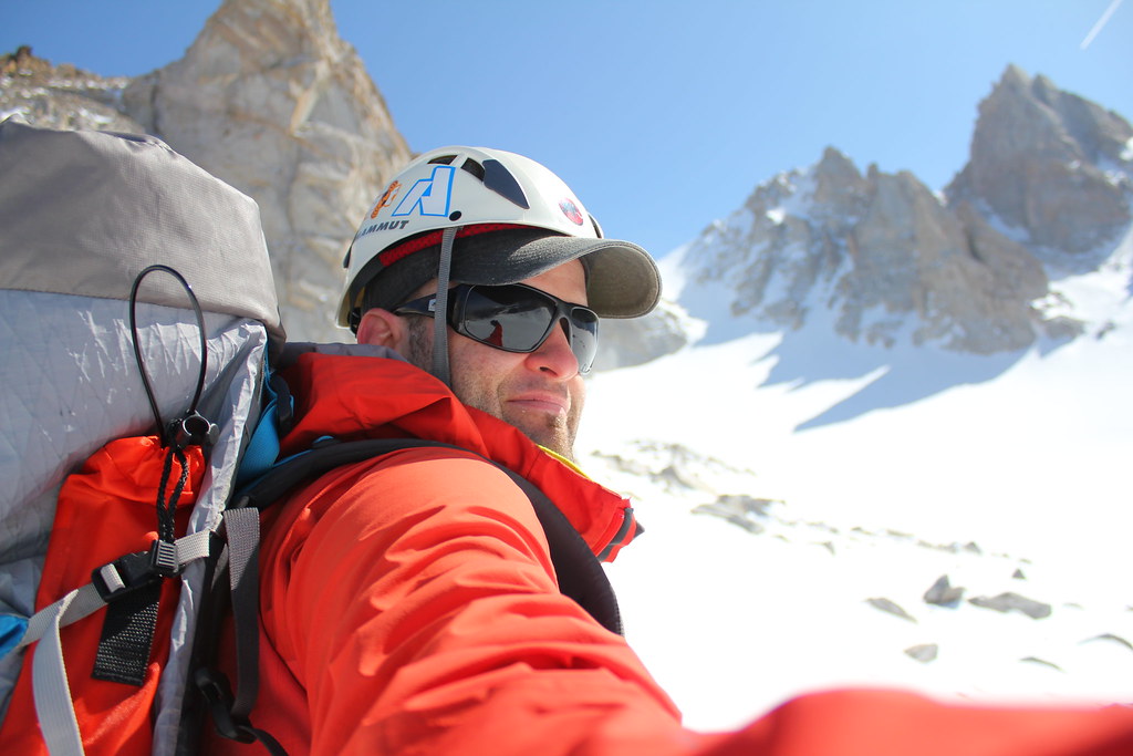
| Me, approaching the Hourglass. |
I shot a bunch of pics, hydrated, and then kept on climbing. The last remains of a couple of previous skintracks--now windblown--appeared and disappeared in and out among the terrain features I was now climbing, and I cruised in each of them for a while so I could get to know a little bit about both of the climbers who'd made them.
I've always found this an interesting exercise... you can learn a lot about a person from their tracks. One climber had a preference for strong sidehilling, and stuck to the higher ground to hang onto every vertical foot gained as much as possible while still going upward. This was a consistent characteristic of that person's line, despite the harder level of work required by sticking to it. That tells me this track was made by a very fit, very strong climber with good endurance.
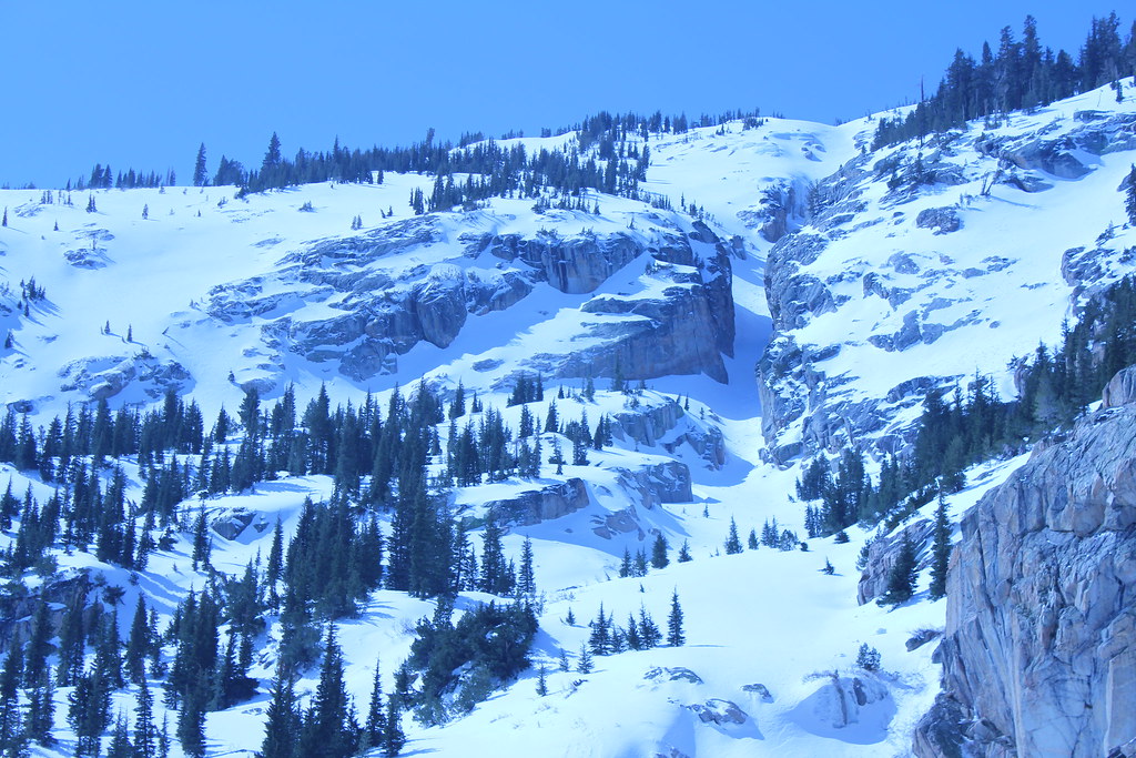
 |
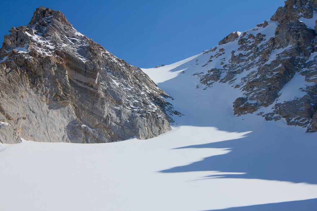
| The AWESOME looking chute on climber's right -- on the way tot he Hourglass. MUST... SKI... |
The other line was the opposite in character, sticking mainly to draws and swayles, with ski tips almost always pointing straight up the fall line for better climbing grip and less work on the legs. Seemed like a more efficient way to get up the hill, but I noticed that for me, the vertical progress on this track was too slow for my liking.
 |
| On top of the Hourglass. Camp is below rock buttress, right of center. |
As for myself, I settled into a groove, and I found I most often split the difference, staying more to the steeper high side line but dropping sideways into parallel uphill terrain to kill some angle and improve grip where necessary.
And before long, it got steep again. Another big wall now loomed ahead of me, this one populated by sparse, small trees and big boulders. Getting up near treeline, I thought to myself.
Just before I started up the steep, I passed the couple's campsite... probably on or near the spot mentioned in one of the trip reports we'd read about for this climb, and likely where Dan and I would have been camping last night or the night before if we'd been able to make more progress.
At any rate, I was sure those two were undoubtedly higher on the mountain than me by now.
After a tough ascent up the backside of the huge southwesterly-running ridge that guarded the entrance to the base of the lower Matterhorn glacier--a slope I later noted on a topo appeared to be an unnecessarily steep line adjacent to the ACTUAL route haha--I once again
topped out, took a rest, and
studied the route ahead to see what was next.
 |
| Lots of interesting features up here. Looking up to the peak. |
Man,
this place is incredible, I thought to myself. So glad I came up here.
Horse Creek Peak dominates. In my head, I'd imagined I'd reach this point and the angle would ease off a bit, because it had looked on the topo like this was the bottom of a huge funnel-shaped basin that ran gently uphill.
Well, I had "funnel-shaped" right, but getting underway and dropping the 40 or 50 vertical feet from my top-out point on the ridge down to the glacier floor, and then rounding the corner left into a narrow trough revealed the next obstacle: the broad face of the glacier, spread across a 130-degree field of view ahead that filled filled my vertical sightlines completely was a breathtaking sight... especially with the summit group's jagged teeth scratching the sky above. With only trace remains of one previous skintrack on it, it looked from here a completely unbroken field of white, and that I was utterly alone in this giant space.
 |
| West couloir at right, summit at middle, and Ski Dreams obscured on far left. |
Incredible.
The higher I climbed, the deeper the wind slab got under my feet, and as I
exited the top of this spectacular section, I noted it had gotten to be about 6 inches deep or more. The snowpack conditions were reported to be excellent here, and that certainly seemed to be the case, but keeping an eye on conditions anyway, I pressed onward and upward, approaching the huge granite wall on climber left that stands lower sentinel over the base of the Ski Dreams couloir, which opened up before me on the left as I climbed ever higher.
The size of
that pinnacle is deceiving. It's SO big that it never really seems to get much closer, even after you start rounding it and heading to the couloir. Suddenly, over the ridge in the direction of the center of the cirque (to my right) I heard voices.
So I climbed higher on a broad flank and then crested another hillock, where I said hello to the couple, who were by now just beginning their ski down from their top-out point just below the arrow-shaped knife-edge of Matterhorn Peak's point, dead center of the basin.
 |
| Ski Dreams dead center, west couloir on the far right. |
They'd climbed up to just below the west couloir and begun their descent in a pair of beautiful intertwining lines, and reported perfect skiing conditions. I could feel the luscious, velvety somewhere-between-powder-and-corn snow under my skis and got hungry to shred some of it, so I said my goodbyes and continued upward a bit more, right to the base of Ski Dreams.
 |
| Just below the Ski Dreams couloir. |
I checked my watch... hmmm... still feeling strong, I wanted to continue up the couloir and then hang a scrambling right to tag the summit. It was so close. But turnaround time (at least the turnaround time I thought would get me back to camp by our agreed-upon time, not knowing how much of the terrain below me was skiable) was fast approaching.
If I got halfway up the couloir and had to turn around, I think I'd have been a little miffed, so I made the decision to go up only a bit more and then lock in for the long ski down. I took a long break and enjoyed the absolute solitude and the overwhelming silence, which was broken only by voices of the mountain whispered in occasional light gusts.
 |
| Looking up Ski Dreams. Probably another 45 mins of climbing to the ridge above. |
Sitting there in that special place overlooked by the vigilant gaze of the mountain's jagged towers and shimmering black pinnacles, it was quite a moment for me. It was certainly the steepest terrain I'd ever covered on skins, and I'd done it on my own (with a little help on the route from previous climbers... thanks, guys!).
 |
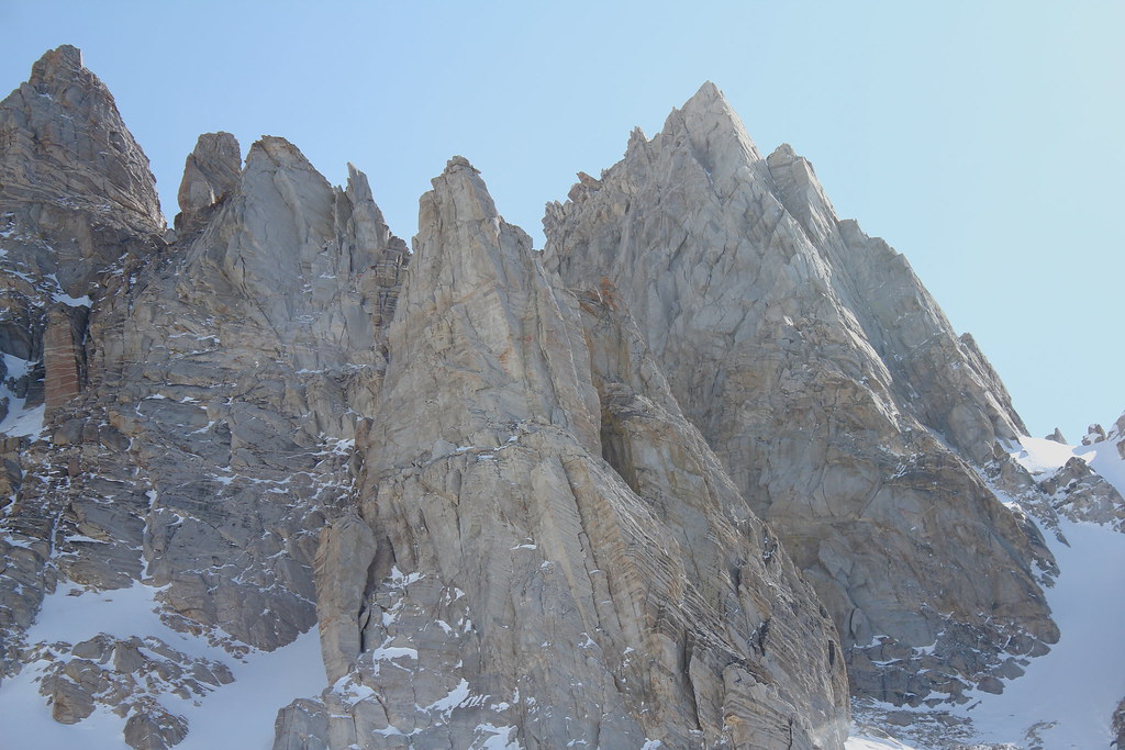
| The summit group. Incredible. Note the couple's ski tracks in the shade on the right. |
I was in no hurry to get out of there, but I also didn't want to get back to camp later than agreed, so the time came, I strapped in, and I was locked and loaded for what was to be the best ski of my life, though I didn't realize it.
 |
| My tracks on the upper glacier. |
And then downward, getting a feel for the snow and my skis. Speed, I found, was the answer in this kind of snow, so I opened up the taps and followed part of the tracks left by the couple on their way down, who I'd heard discussing multiple routes to get back to their camp (which I'd seen earlier).
After carving some fun lines in the upper glacier, I stopped to find the correct line. And I noticed I couldn't wipe the stupid smile off my face.
The reason for the stop was because I wanted to make sure I wouldn't have to boot out of the trough at the bottom of the glacier to get back to skiable terrain. But me grinning wasn't helping my concentration. HAHA
 |
| Yup. Stupid permagrin on my face after that first little bit. |
Nevertheless, I made the decision on where to go, pointed my skis downhill, and felt the alpine wind rush into my face once more, letting speed be my friend for control as the snow gave me the perfect soft ride, as if in reward for all the hard work it took to get up it in the first place.
I decided I'd go straight down over the glacier (avoiding the convexity in the middle of it) and then hang to skier right to see if I could use my speed to sneak over the huge ridgeline I'd climbed earlier. My goal was to get myself into some of those rollovers and chutes I'd spotted from below.
I'd chosen well. Dan later said he spotted me as I crested that ridge, and he watched me ski most of it, leaving a record of my joy in the snow behind me as I crushed the vertical out of my day.
With the sun shining in bright approval, I found endless possible lines on the front side of the slope, noting that by staying left, I could drop into that huge, dramatic chute lined with big cliff walls I'd peered into on the way up. It had looked a little rough in there from previous skiers, so I avoided it and stayed skier right, instead nailing the top half of an unskied couloir and crossing rightward, dropping into the bottom half of an adjacent one.
 |
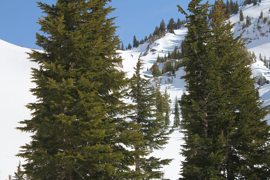
| I skied the two couloirs between the foreground trees, then cut skier right to the Hourglass. Note climbers ascending. |
There, I spotted two more climbers at the bottom of what I was about to ski, so I stopped to give them a chance to clear the line in case it avalanched on my way down. (It didn't.) I pulled up next to them and I reported the conditions above, we chatted for a bit, and then it was back onto the down for me. I cut across the bottom half of it to the right.
The reason I was pushing right the entire way down that face and having a blast doing it, using the terrain to my advantage was to get all the way back to my final goal of the down: the Hourglass. I'd been stoked to
It had had sun on it most of the day, but the temps had remained quite cold up here, so I expected it to be the an incredible crescendo and an awesome finale to a breathtaking ski--and it did not disappoint.
Unbroken, I ran a huge line down the center of it at high speed, noticing that the faster I went, the better the skiing got as I descended into slightly heavier snow.
I arrived back at camp well before our agreed upon time. Wow, I'd gotten down FAST, leaving fresh tracks in my wake all the way down the mountain.
I plopped in the tent and rested up while Dan graciously cooked up a big meal for us, and then we relaxed. And then 3 hours later, decided that instead of staying another night on the mountain, we'd break camp NOW and bolt for the car... which we did. We skied to the very last bit of snow on the trail before we packed them of for the last time and booted out.
Oh yeah, and that waypoint I marked for the elusive bridge on the way in? It guided us back after getting lost in the woods at the bottom and tromping around for an hour with heavy packs on. SWEET!
Matterhorn Peak, I'll definitely DEFINITELY be back to you.


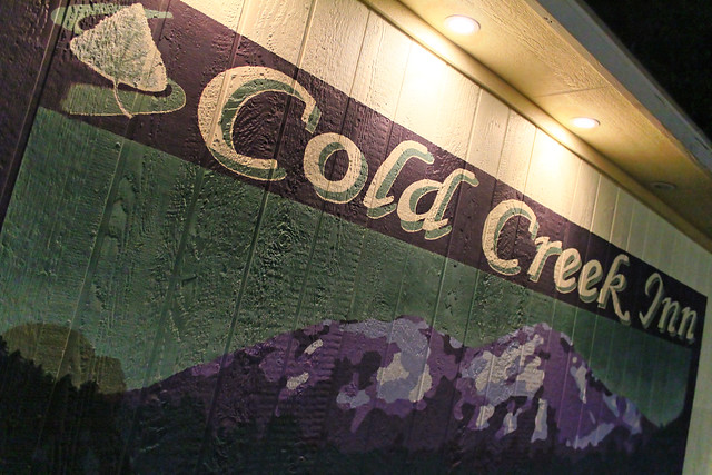 We drove the usual 5.5 hours to mountain, stayed at the Cold Creek Inn (not without considerable homophobia drama from Greg, I might add... damn, I wish I'd gotten video of that hahaha), had a tasty dinner, went downtown to the Vet for a drink and ended up staying to play pool for a while, then crashed.