Tuesday, December 7, 2010

More photos from Alaska - May, 2010

Jason Thompson, our lead guide for the AK seminar this past May, created some short films about the course, starring... US! Haha I saw him off in the distance filming a few times, and always wondered what some of those images looked like... so I took some of the video and created stills from it. They turned out pretty cool. He's a good photographer/videographer! :-)

(I'm the one in the red jacket in all of them.)


Heading up the glacier to Mt. Frances Basin - Kahiltna Queen in the left background, North Buttress of Mt. Hunter on the right.


Dropping down into a giant crevasse during rescue training

Moving up the glacier to the Mt. Frances basin - The Kahiltna Queen in the left background, North Buttress of Mt. Hunter behind me

High fives on the summit of Mt. Frances, after successfully climbing the East Ridge.


On the summit of Mt. Frances. The stunning Kahiltna Queen is in the background, wrapped in a cloak of cloud.


Tuesday, November 23, 2010

A couple more pics from Mt. Superior

This is what it looked like near our top-out point on Mt. Superior just before we turned around. Tyson took this pic of me crossing some steep slabby stuff  (with pretty serious exposure) that led to the decision point.

Near the turnaround point in 40+ mph winds.

Monday, November 22, 2010

Stormed off of Mt. Superior, Utah - Nov 20, 2010

Watch for links to video below, and click the pics for larger versions.

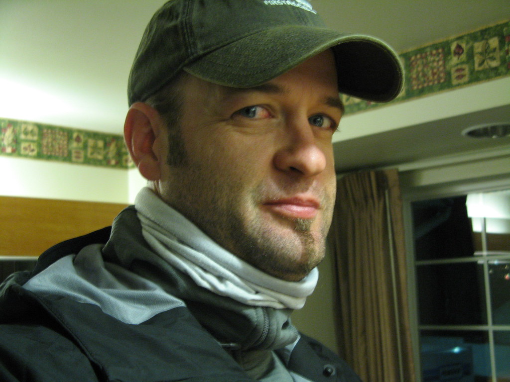
At 5:13 in the morning, anything is possible (except, perhaps, finding an open breakfast spot). That's probably why I imagined myself standing on top of Mt. Superior this morning when I woke up. The flight here yesterday had been uneventful (and catastrophically boring), but now it was time to get up and get moving for the climb.


After a wildly unsatisfactory McDonald's stop (and a 7-11 run, where I found 
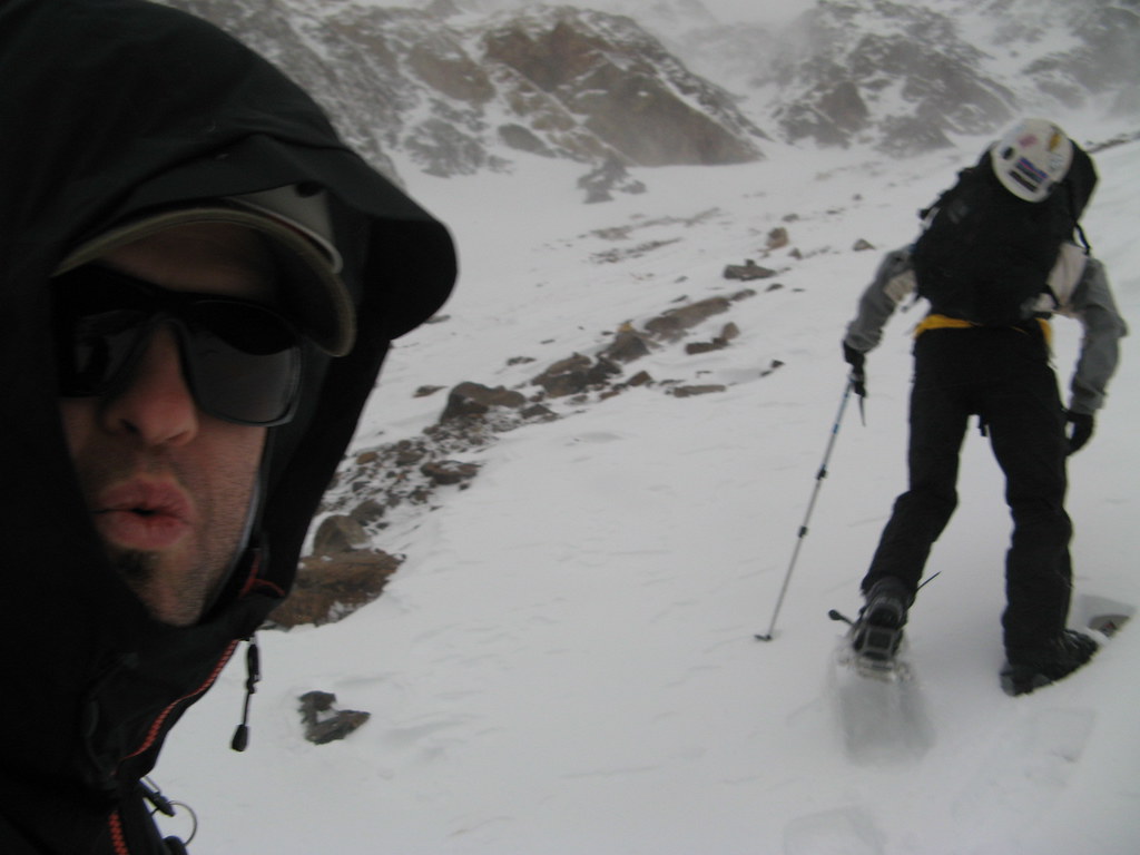
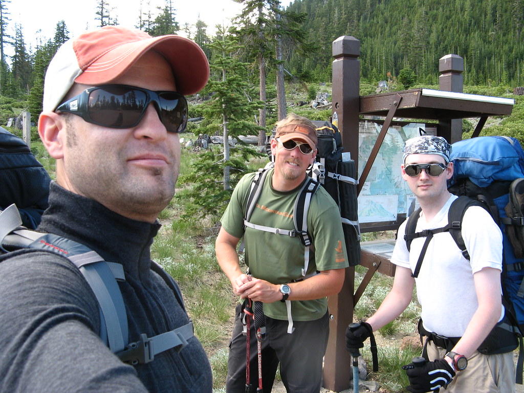
The Holy Grail Of Hostess Products, I pulled into the Park N' Ride parking lot at the mouth of Big Cottonwood Canyon, where I was to meet up with Tyson Bradley--our guide from Utah Mountain Adventures--and Norm, my fellow climber for this trip. We ran over a few details about the climb, piled into Tyson's car, and set out for Little Cottonwood Canyon a few miles south.
The roads were in good shape, and we had no difficulty getting to the base of the route, where we checked snow conditions with our feet to determine whether we needed to bring the extra weight and bulk of the "slowshoes".

We had some discussion of the expected weather, and Tyson solicited the thoughts of the climbing party on which route to take. The original plan, of course, was to go up the more technical south ridge as a mixed snow and rock climb; then walk off the summit down the more gentle east ridge, heading toward Alta before glissading down one of the south face snowfields on what he thought would likely be stable snow.

The dilemma was threefold: Do we do the south ridge as planned, with the winds on the mountain predicted to be high, and a storm front moving in? Or do we choose the east ridge as our ascent route to give ourselves a better chance of summiting in what was shaping up to be bad weather? Or do we wait until after the storm tomorrow and try again?

Waiting would have been a good option, but with heavy snowfall in Saturday night's forecast, the whole area would become one great big avalanche hazard. Ultimately, we decided to attempt the original plan, and decided in advance we'd turn back if it got just too sketchy high on the mountain.

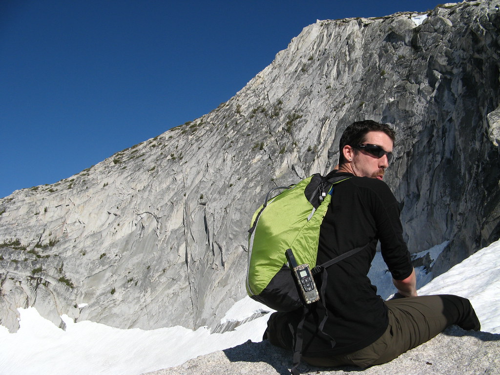
We parked the car, piled out, and threw on our packs. Mine weighed in at around 30-ish lbs... probably (once again) too heavy, but experiences like this are all part of working on my methods for paring the weight down.

It's weird... It's sort of somewhere between an art and a science, knowing how much crap to take with you in your pack. The decisions for me to take some of the extras often come down to those items that might help me cope in a wider variety of scenarios, but I'm finding that usually, that extra stuff isn't worth carrying. The reason is that under most circumstances, you'll never need it, and the idea is to plan your trips and act in a way that helps ensure you wont... meaning climbing safely.

I'm a safety boy, and my Boy Scout dad taught me well to be prepared... so from that perspective, it's sorta tough for me to leave those things behind sometimes... and I almost ALWAYS either overpack or underpack on food, which is kinda weird, too. But I'm doing better. (Plus, it's helping to have Foraker on my list as a goal to start keeping my pack weights as lean as possible. Alaska is much less forgiving... and it's a great lesson for any outdoor activity that involves carrying crap on your back, too.)

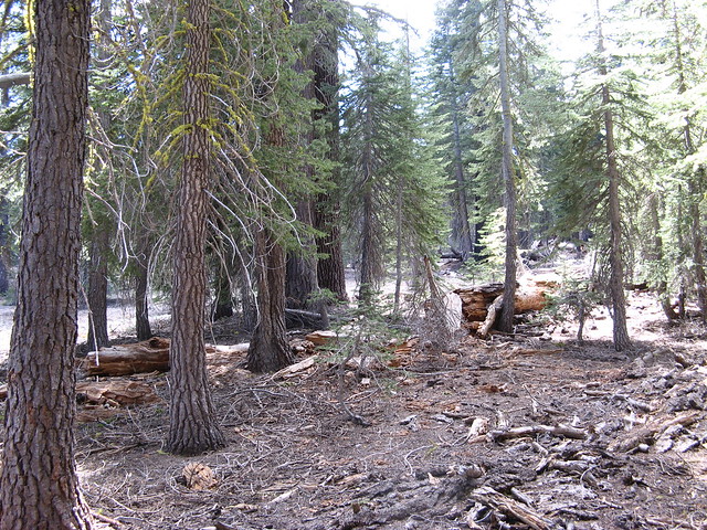
ANYWAY... with our hardshells and an extra insulating layer underneath our packs, we were prepared for what was forecast to be some potentially wicked weather up on the mountain. Snowshoes reluctantly in hand, we tromped up the road about a quarter mile to the base of the route, which begins at the bottom of an avalanche runout zone from high off Mt. Superior.

Side note: Apparently, avalanches from Superior run out far enough down the lower apron of the mountain (and beyond) every year to completely block the road, which is why they built a second bypass road that splits off from the main road and goes to the other side of the canyon. When the mountain avalanches the main road, traffic just gets redirected. Interesting.

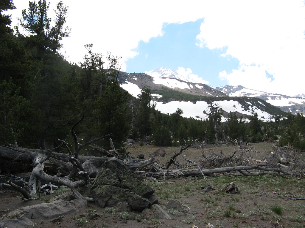
We crossed the main road northward, and talked as the wind started to kick up. We strapped on our snowshoes and began picking our way through the gaps in a broad swath of bushes that protected the base of the mountain, and headed up the broad, rolling apron, aiming left toward a large triangular outcropping of rock.

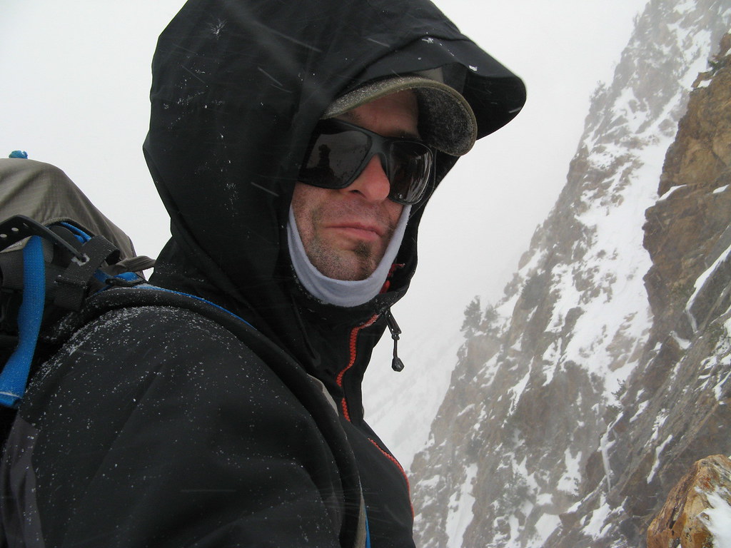
The wind seemed to be aware of our presence, and it howled its raging disapproval, periodically throwing huge, swirling clouds of airborne ice at our backs, and stinging our faces with needlepoints of pain and cold.

The gusts were so sometimes so strong that the best we could do was turn our back to it, hide inside our hoods, cover our faces with globed hands, and crouch or kneel to lower our center of gravity to prevent us from being swept completely off balance. Up over the apron we went, with the wind finding any patch of exposed flesh, the tiniest clothing gap, and occasionally punishing me for looking back over my shoulder at just the wrong moment for Norm, as if delivering a swift retribution for daring to lift my head.

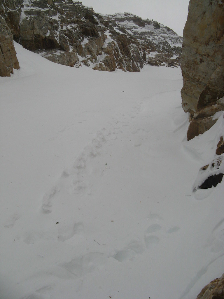
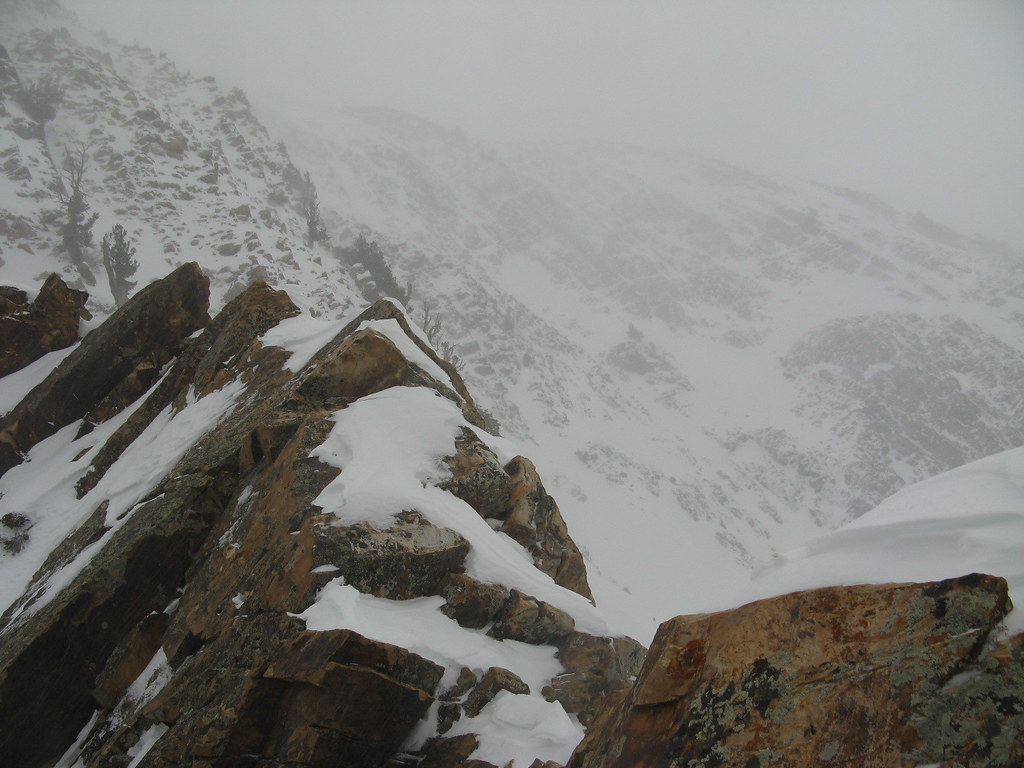
At the outcrop, we did a quick transition from snowshoes to crampons and continued up through the entrance to a steep, narrow couloir--the Suicide Chute, it's called. The entrance to the chute is guarded by huge standing angular rocks--like hungry lions guarding the entrance to a sacred place.

Once inside, towering rock walls rose steep and high on both sides, creating a deep, narrow, snow-filled channel that runs all the way from the bottom of the mountain up to a col at about 9,800 feet, no wider than probably 30 or 40 feet at any point.

The wind continued to worsen as we climbed, accelerating in ferocity, no doubt exacerbated by the presence of the steep, confined rock walls of the chute within which we climbed upward. As the wind came in from the east, it hit the mountain, and swirled violently in angry eddies upward through the lower portions of the chute, pummeling us with gale force.

And every time it came, it pelted us with massive swarms of BB-sized, sugary ice and snow crystals, flung at us with all its might as it blew up the hill. (The noise of this inside a hardshell hood is really loud! Hahaha)

When possible, I would try to take advantage of Mother Nature's wrath, using her gigantic uphill gusts to propel me straight up the fall line in quick climbing spurts instead of the energy-saving traverses most often used. She literally pushed me up the steep slope in places—fun.

The path up the center of this narrow canyon rose sharply above us in a dramatic left-bearing direction around the huge rock buttress created by the south ridge, and as I clambered up over a few patches of rock and ice, my spikes thudded and squeaked as they bit in for purchase.

We continued upward, thinking we'd eventually get into a protected area away from the wind for more stable climbing, and after a break, that's exactly what happened. We walked around a huge corner of rock and stepped into complete calm— a windless, serene, and almost ethereal space in this dramatic snakelike couloir.

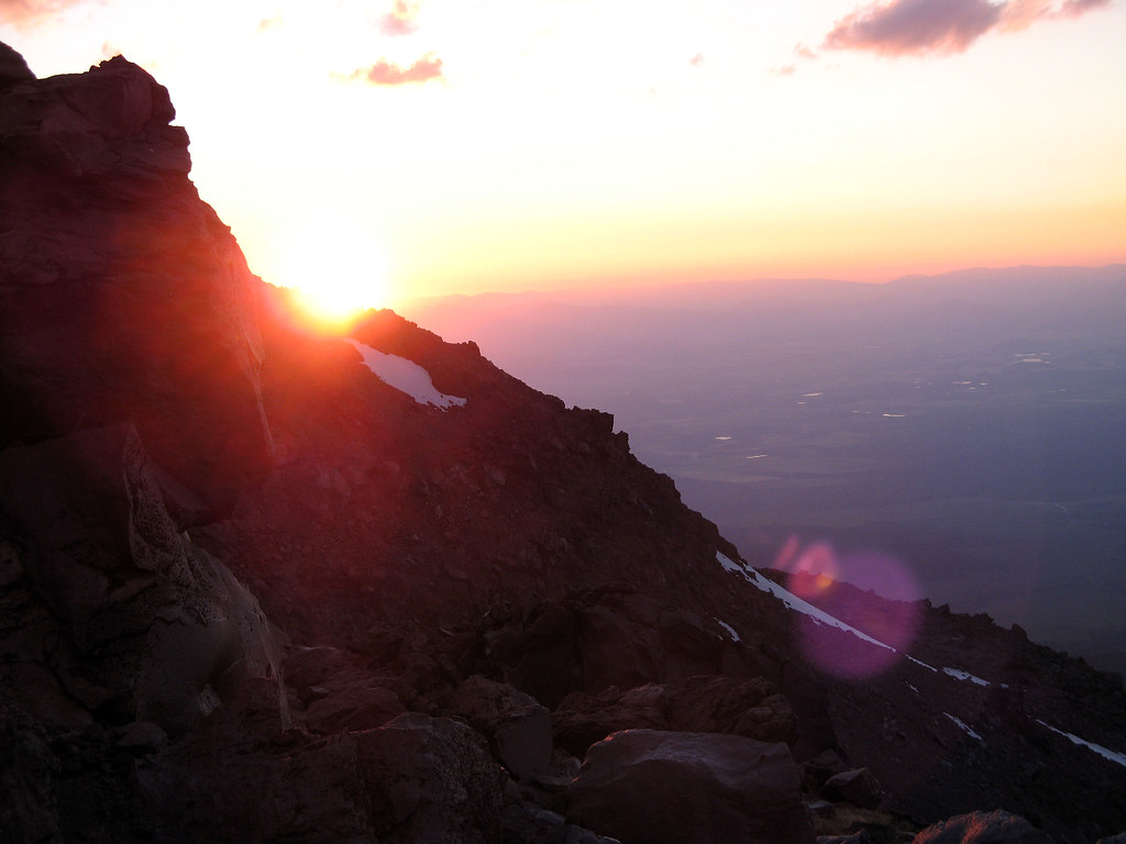
As a dull gunmetal dawn broke around us, we could hear the now-feckless wind screaming its anger below us, as though it had lost its favorite toy (us) somewhere in the fray--and it wasn't happy about it. Frantically, angrily it hunted us, but to no avail.

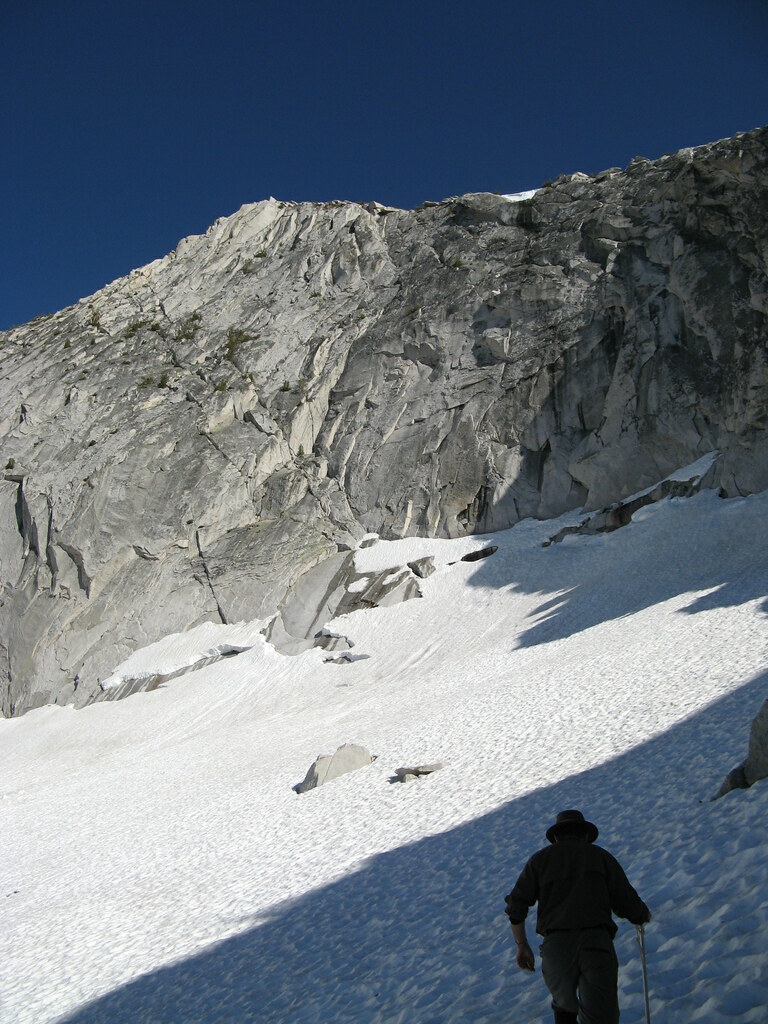
The calm that enveloped us was a welcome break that allowed us to do some focused snow climbing, broken only by areas of near- fruitless struggling through thigh-deep sugar-snow that ran like sand around our feet. As we flailed one step back for every two forward, the mini avalanche rivulets we created ran between our legs and ankles, down the slopes below, as new spindrift poured off the couloir walls above our heads to replace it.

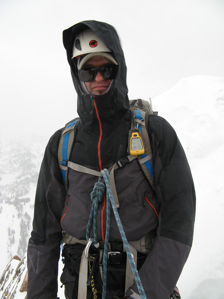
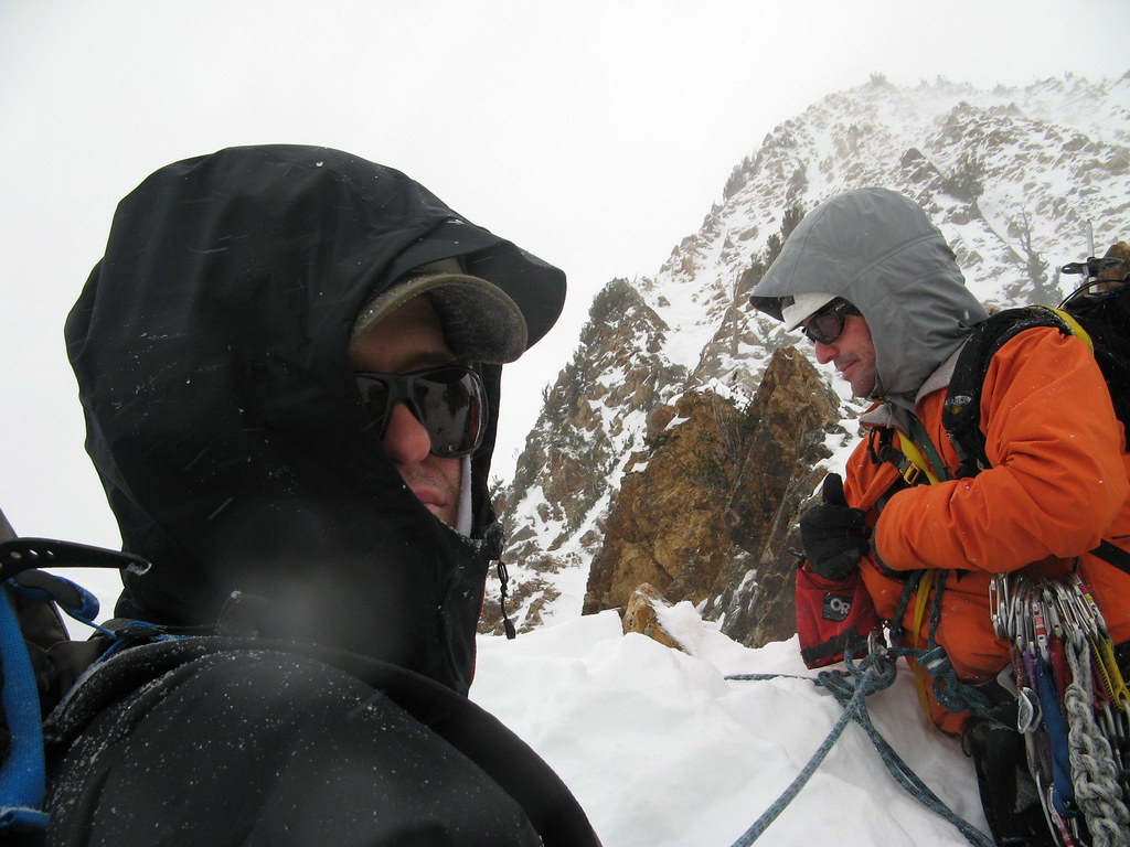
Far above us, the col on the south ridge slowly came into view, and we decided to take our next break in the still-protected section just below it. Once there, we stomped out a small platform, got into harnesses, and roped up for the next section of climbing, which was now transitioning to a steep rock ridgeline.

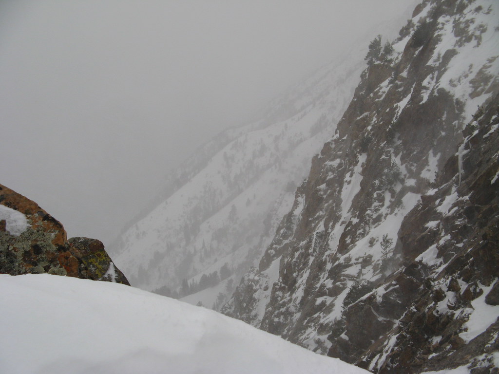
The wind now blasting over the col above our heads was a completely different animal than the seemingly sentient, salivating, screaming-adolescent banshee of a creature we'd encountered below. Above the calm of our canyon, this animal made a vast, booming sound, a growling, freight-train-like low-frequency roar that blasted an ancient and unrelenting rage against anything unfortunate enough to be on that ridge with it.

We discussed our next steps, and decided it was at least worth a look up there to see just how bad it was—even if it was overly optimistic—so with Tyson leading our rope team, me seconding, and Norm behind, we ascended up and out of our quiet little chute and into the maelstrom.

The sound of it was deafening, and utterly unlike anything I've ever heard before. It battered us and ripped all spoken communications from our throats, hurling them to their wordy deaths down the steep, jagged face of rock and ice on the west face far below.

The plan was that Tyson would set up a series of running belays: he'd place the protection in cracks and around protruding points of rock, and then clip the rope he was trailing through it. He'd then climb until I reached it in the middle of the rope at my harness, and then wait until I'd clipped around it before continuing.

So immediately off the col, we turned sharply right and began climbing a steep right-slanting series of cracks and ledges. About halfway up this section, the wind finally began to drill through my warmer gloves, and my hands and fingertips began to get very cold indeed. A quick bout of arm-swinging cured that problem, however, and I continued—up and to the right, baby… up and to the right.

I, as the second of our three man rope team would clip around the placements as I came to them, first clipping the back strand of rope before unclipping the forward strand from my link to the protection Tyson had placed above. And Norm, a rock climber with limited leading experience, brought up the rear as he removed and collected the anchor hardware.

The immediacy and angle of the rock ascent straight out of the chute took me a little bit by surprise, but I soon had the cautious hang of it, and I got a better feel for what I was doing quickly. That said, footholds and handholds in gloves, crampons and several insulating layers plus a weighted pack are quite a different matter than rock slippers on a sunny, warm day in shorts at the crag.

Neverthess, it was clear that I need and would benefit greatly from more exposure to this kind of climbing in addition to time on the crags. Learning to be a little more efficient in my movements will be a key element of my success in the mountains, I think.

And yet THIS is what I longed for… doing it all in heavy gear, challenging my senses to stay foused, to feel what my hands are doing in relation to their purchase on the holds, with a layer of glove between skin and stone.

Certainly, the sensation of "airyness" as put forth in the climb description—that sense of very steep cliff walls falling away into thin air with long drops beneath your feet, the feeling that a slip might result in a midair dangler—was quite accurate. And though we'd not yet even ascended to the point on that knife-edge ridge where we were under hazard of the most significant exposure along this route, it was an exhilarating feeling to be there… really DOING it.

Once through the first rock portion, we stepped and climbed around a jutting corner of rock that took us out onto a short, steep slabby section of less featured stone that dropped sharply down and to the right into another steep couloir below—with far fewer good holds for hands and feet on it.

I was able to use the frontpoints of my crampons fairly well through this section, however, by jabbing them into stable cracks between solid pieces of stone. Tyson was waiting at the top and providing some feedback on the moves (and a belay), so that was helpful, and I got across it without too much trouble.

Once across, I stepped back onto the steep snow slope that led up to Tyson's position above, and up I went. As I waited for Norm to come up behind, I checked the altimeter: 10,242 feet: 800-ish vertical feet below the summit.

At Tyson's lofty perch on a ledge of the rocky ridge we'd just climbed, he called a pow wow to discuss whether we should continue. Tyson knows this route well and understands what's to come, so he laid it out for us, along with his recommendations. That the forecast for high winds was "verifying" was an inescapable reality. And based on his thoughts, the question of whether we should continue seemed only to be a question in the academic sense at this point. Nevertheless, it was a good discussion.

In our guts, Norm and I, I think, already knew the answer: time to turn back—unacceptable risk ahead. Tyson agreed. Furthermore, in his much more objective and expert opinion, retreat from the point at which we stood becomes increasingly more difficult should the wind outmatch us higher on the mountain. There was also the fact that in the face of 60 MPH gusting winds where we were, rock climbing crux moves of 5.6 at higher elevations become a lot tougher than 5.6.

More important, however, was his concern that should one of us be hit by such a gust in the middle of a delicate rock move in one of the exposed sections of ridge above us, the situation could become an epic in a hurry. None of us wanted that, so he suggested our summit dreams were likely dead. Though disappointing, Norm and I agreed and sounded the retreat.

But even unsuccessful, the ascent was not for naught. Tyson transferred part of his rack to Norm, who led on the way back down. Norm got some practice placing protection, and Tyson evaluated his placements as he removed them on his way down and gave Norm feedback on their quality.

The downclimbing was fun, and I was able to move a little faster this time, just because I'd grown a little more accustomed to the activity. Focus still paramount, we moved back down off the small sideways slabby rock section, back around the rock corner, downward and leftward into the lofty vertical-ish ledgy stuff, dropped back onto the narrow col above the Suicide Chute, and descended back into… a deafening calm of windless peace once more.

As the brash and bellowing freight train wind above us thundered its baritone discontent and lashed the trees on the ridge, Tyson conducted a mini clinic on placing protection with active cams and nuts, and Norm set up an equalized 3-point anchor system for practice.

We all munched some food, had some water, unroped, and began the glissade down the chute, back into the waiting jaws of other reproachful, more high-toned winds far below.

With relatively stable snow conditions today and some avalanche education from Tyson (but keeping a mindful eye on the possibility of avalanche in the chute), we lost altitude quickly with a combination of buttslides and plunge steps. We treated this descent as a backcountry ski descent: one at a time, waiting in avalanche-safe areas below and leapfrogging each other as we went.

The flying torrents of spindrift became so ferocious near the bottom of the chute that my glasses completely froze up at one point and a tiny patch of exposed skin on my forehead between my hat and glasses began to ache from the violent and repeated ice crystal sandblasts.

For a minute or two, I could see nothing of one glissade stretch. Luckily, I was in the middle of a pretty straightforward and controlled slide when it happened, so no harm done. We all switched to goggles just before the couloir spat us back out onto the upper apron once more. It seemed to me as though the rock sentinels guarding the entrance to the Suicide Chute glared at us as we passed between them, bludgeoning our way through thigh-deep posthole snow.

Eventually, Norm and Tyson go frustrated with the hard work of breaking through the crusty snow and switched back to snowshoes, but I figured by the time I got mine on, I could be nearly halfway back to the road if I really kicked it in the ass. And, I reasoned, I could burn a lot more calories struggling in the snow than floating over it, thus making up for some of the lost effort we'd missed out on by not finishing the last 800-1000 vertical feet of climb to the summit.

Ordinarily, I'd never do that, simply because struggling in the snow is a huge energy sink, but once on descent of the upper apron out of the col, a safe return was pretty much assured, so I worked hard on purpose :-) It was fun!

Discomfort is a way of life in the high mountains, and disappointment is sometimes not far behind, so I'd say I learned many valuable lessons today, both physical and mental. And though I am indeed disappointed that I failed on Mt. Superior (this time), it helps me understand more about myself and how I'll handle that disappointment on larger objectives. It's certainly a good possibility on Foraker, a mountain with a mere 30% summit success rate.

But I'll be back another day for another attempt on Madame Superior. The prospects of going to the top by that route are exciting indeed, and I've only just had a taste.

Monday, November 8, 2010

I've got one more climb in me for 2010!

Just booked an alpine-style trip with Utah Mountain Adventures (formerly Exum Utah, apparently) up Mt. Superior (11,050 ft) in Utah. The base of the climb starts right across the road from Snowbird in Little Cottonwood Canyon, as it turns out, and heads up a formation called Suicide Chute... cool!

Being that I grew up in the Salt Lake area, I've hiked, camped and backpacked quite a lot all over the place out there, but never delved into the myriad mountaineering challenges that exist practically everywhere. That makes me super exited to log my first alpine-style mountaineering trip in the Wasatch Rockies and bag a summit I've never been on in the process. STOKED!

It also presents an interesting opportunity to get some winter camping practice in for Mt. Foraker (pic at right) in April 2011, as well. I got thinking... instead of booking a hotel in the Salt Lake valley somewhere, I'd maybe just pack up the Trango 2, the winter sleeping bag, stove, and a bunch of food and just... pitch a camp right next to the start of the climb on the 19th! Why not, right?

That way, I'll be there bright and early for a quasi-alpine start the morning of the Superior climb on the 20th, and I'll be able to crash out there for the night--AND do some more climbing in the morning and day of the 21st before I have to break camp and head back to the airport.

Pondering...

Wednesday, November 3, 2010

Sierra Nevada classic climbs

Hmm... for the last few months, I've been trying to figure out where I could possibly find a compilation of great climbs in the Sierra that I could just kinda parse through and pick and choose what's right for my skill level at any given time. The kind of list I could use to plan them as full-on objectives if necessary, find new training grounds, gain more experience, build my climbing resume, and bag a few peaks in good style--instead of just sorta fumbling through a variety of Summitpost descriptions for things I happen to hear about at random.

Guess I could have gone out and found a book on the subject, but I never did. Anyway, completely by accident this morning as I read through one of Rich Meyer's Sierra Journa articles, I spotted this in the sidebar.

Totally awesome.

Monday, November 1, 2010

Not bad for my very first season as a mountaineer!

Update: I'm officially booked for the following upcoming climbs:


- Mt. Superior (11,050 ft.), Utah - November 20, 2010
- Mt. Foraker (17,400 ft.), via the Sultana Ridge, April, 2011

Annnnnd... stay tuned, cuz in addition to all the AK blogs, I'm working on getting my previous 2010 trips up here, complete with photos and video:

- Three 10k+ Yosemite summits in 3 days, June, 2010
- Mt. Shasta (14,178 ft.) via Hotlum Bolam ridge, July 2010
- Mt. Shasta (14,178 ft.), solo, via Hotlum Bolam ridge, August 2010

Tuesday, October 19, 2010

July 18, 2010 - Climbing to base camp

Watch for links to video below, and click on the pics for larger versions!


I got up early today so I could have breakfast at a little place on Shasta Blvd (isn't EVERYTHING on Shasta Blvd here? haha) , but before I went for food, I scouted the location of the climbing store where I was to meet up with my climb team. There were a few people starting to congregate out front, but he 5th Season's doors were still closed, so off I went to grab a bite. Tasty… eggs benedict, some pancakes, and the like.

Afterward, I headed back to the store, which was now open, and met my guide for this trip, Rich Meyer. He's a big, burly dude with a big personality, and I figured we'd get along just great. My fellow climber was a guy named Rutherford (uh… really? Who names their kid "Rutherford"?), a slight, and gooshy fellow of what looked to be about 38 , sporting some goofy glacier glasses, pasty skin, a weak chin, an unbelievably wicked combover, and a very quiet walk-behind-the-man kind of GF/wife in tow.

Apparently Rutherford has climbed a lot of huge mountains in Europe, South America, and other places in the world, and rattled off an impressive resume of major peaks when Rich asked him what mountaineering experience he's had.

That was a bit of a surprise, given his appearance… but then appearances can be deceiving. No matter how you slice it, though, Rutherford is a weird dude, and so is his partner/wife/GF.

I found out later on the trail that she is from Russia... maybe she doesn't speak any English, or is a quiet mail-order bride or something… but I'll get to that whole bizarro experience on the trail in a minute haha)
Nevertheless, my paltry experience just sounded stupid by comparison. haha

The three of us finished our preliminary gear check out back, stashed the stuff that didn't make the cut, and it was at this point that Rutherford began wondering aloud to Rich about things his GF would do while he's gone for the next 3 days, since she wouldn't have a car.

Wait, what? Why doesn't she drive you to the trailhead so she can keep the car? Ohhh… she's a halfwit… I see. And she doesn't drive, and the implication is that she's also completely incapable of figuring out her own program while the big bad nerd-climber is away? Wait, why didn't you guys think of this before coming here in the first place? You've had months to figure this out.

The Hotlum Bolam Ridge is the spine of
rock about halfway up that runs upward from left to right,
starting just left of center
He made the decision to leave her behind, carless for three days in Shasta City while he conquered the mountain… (so weird), and then we all struck out in separate cars caravan-style northward, heading around the western flank of the mountain toward the trailhead. As we drove, the route we were to climb came into view, too... pretty incredible.

Our turnoff was Military Pass Road, a long, very dusty, and bumpy road that twisted up into the foothills and snaked around the northwestern side of the mountain to the North Gate trailhead. Here, it was officially time to get climbing. We parked the cars, changed into our climbing gear, and took the last civilized bathroom breaks we'd have for a while.

Me, the awesome Rich Meyer, and the impossibly weird Rutherford
On our way past the Forest Service trailhead signs, we registered, paid our summit fees into a dropbox, and ohhhh yeahhhh, picked up the obligatory poop bag packs. Yeah… you have to carry your crap off this mountain, too :-)

*ahem* I will now detail the standard poop kits provided by the Forest Service:

1. A brown paper bag with some kitty litter in it

2. Large fold-out paper target (!!) for aiming properly

3. A pair of ziploc bags

So when you need to take a dump while on the mountain, you take out a kit, pull out the paper target, unfold it on the ground and put a rock on each corner, and hope your aim is good as you shoot for the center of the target. When you're done, fold in the corners and roll it up like some crazy, weirdo poop burrito, put that into the paper bag, then put that roll of warm happiness in the Ziploc, and then put the whole thing into the second ziploc. If you're careful, I'm told, you can use each one twice, which precludes the need for carrying more. They're bulky, and they take up room and add weight to your pack, so less is better. AWESOME! Hahaha

With all our crap sorted (so to speak), we at last headed up the trail for a 4-ish hour climb into the moraine at the snout of the Hotlum glacier where we'd pitch our base camp.

Beautiful, dense pine forests on Shasta's north side
It was a hot day, but there was plenty of shade to be had, and with Rich in the lead, me second, and Rutherford bringing up the rear, we talked and hiked. Mainly, it was Rich and me talking. He'd shout something back over his shoulder, and either Rutherford or I would answer, but then Rich and I sorta settled into the usual "why we climb" kind of discussion… the risks we take, the people that die doing what they love in the mountains… nothing too out of the ordinary or sobering, but it lasted about 40 minutes, throughout which Rutherford was mostly quiet, only chiming in a few times.

At almost exactly an hour up the trail, Rutherford speaks up behind me.

Rutherford: Uhhh… guys… Can we stop for a minute? I can't be here. There's something I have to take care of.
Rich: (thinking Rutherford had to take a dump) Sure, man… We can just wait here while you go do your thing.
Rutherford: No, I mean there's something I have to do. I really can't be here.
Rich: Yeah, seriously, no problem. It's cool… we'll just wait here and…
Rutherford: No, I mean like I have to go do something.

I was just as confused as Rich at this point. "WTF are you talking about, dude?" is what I was thinking. HAHA

Rutherford: I've just been thinking for a while, and I realized I shouldn't be here, and there's something I have to go take care of.
Rich (realizing what dude is talking about): Ohh, wait wait wait hang on a minute… you mean you need to TURN AROUND and go back down?
Rutherford: Yeah.
Rich: Ohhhh… wow… *stunned* Hmm…. Well, this has never happened, so
Rutherford: Yeah, but I'm really ok, I'm fine. I just can't be here.
Rich: What's wrong? Are you not digging the conversation? Was that bumming you out, or what?
Rutherford: No, the conversation isn't what sparked this… I just can't be here.
Rich: Are you feeling ok medically? Are you lightheaded or feeling dizzy or sick or anything? Are you hurt? I mean, I don't wanna get into your business, and now I get what you're saying, but by the same token, you have to understand, I'm responsible for your health and well being up here. I can't just let you turn around and go back down by yourself, so you've gotta give me SOMETHING that tells me what's going on. All three of us would have to go down to take you back if I don't think everything's cool.
Rutherford: Nonono, I'm totally fine… I just realized I really should go take care of this, and I can give you guys back the group gear I'm carrying, and such…


Heading toward the alpine zone after
Rutherford's bizarre departure

It went on like this between them for a bit, Rich doing his due diligence, me going "OMG! WTF!" every five seconds at this dude's el bizarre behavior. Made me wonder if the talk about why we climb WAS getting to him, and he was feeling extraordinarily bad about leaving his strange wife behind for three days—carless—while he's out on a mountain enjoying himself. He denied it, but, still… I dunno.

Anyway, after it was determined that nothing was wrong with Rutherford *uhhh… relatively speaking haha*, an arrangement was struck for him to go back down the trail alone and immediately contact the head of SMG to let him know he got down ok. Then we traded tents and shuffled some group gear around, and then Rich and I continued the cruise up to 10,000 feet and a comfy basecamp in the glacial moraine.


Finally above treeline... and onto
the lower snowfields
 We made good time and found a good spot in the moraine near some pure, running glacier water streams, pitched camp, and cooked a hearty dinner. We had way too much food for the two of us now, so we ate heavy and enjoyed every bite, storing up our energy for the coming summit climb tomorrow.

A breathtaking sunset washing us in bright pink and orange hues combined with brilliant colors out over the valley and behind dramatic outcrops of nearby rock were our reward for today's hard work.


The final grunt up that snowfield leads to 10k basecamp
 The views from there are phenomenal, too. Rich and I put on some puffy gear to keep warm as a light breeze kicked up, and stayed up for a while chatting, but ultimately went to bed early for an alpine start at 2am.

Realllly looking forward to the climb tomorrow.

Sunset from 10,000 feet on Shasta is a beautiful thing.


Monday, October 18, 2010

July 17, 2010 - Shasta City and Mt. Shasta's northeast side


Mt. Shasta in the distance. Avalanche Gulch is the huge
bowl on the right side of the mountain
Watch for links to video below, and click on the pics for larger versions!

Mt. Shasta has been on my radar for some time, now. At 14,178 feet, it's a breathtaking and imposing monolith that towers over the tiny towns of Mt. Shasta City and Weed, and now that I have the foundation mountaineering skills and some background from my time in Alaska, the time has finally come to climb it.


(Weed itself is a place that holds many memories for me, too. My band Trip Device recorded part of our album titled "Inside I Feel" at Radiostar Studios (in Weed) with multi-platinum Grammy-winning producer Sylvia Massy at the helm... cool days.)

Me... on the long drive.
 Anyway, having just returned in May from 10 days of mountaineering skills training, I felt confident I could tackle something on Shasta that was a little more challenging than the standard south side Avalanche Gulch route. As beautiful and challenging as Avy Gulch certainly is, I was looking for something on the mountain with a little more oomph.


So I did a little poking around on the internet to evaluate the skills required for a number of routes, talked to the people at Shasta Mountain Guides, and ultimately booked a 3-day guided northside climb up the Hotlum Bolam ridge: the ridge that divides the Hotlum and Bolam glaciers. It seemed to me a perfect route to continue pushing my skills as a climber: it's glaciated, has lots of sustained vertical, and has variations with access to steeper terrain.

I wasn't quite as maniacal in my training for Shasta as I was in preparation for Alaska. The fact that I'm already in excellent climbing shape, and that my expected pack weight on Shasta is considerably less--more like 35-45 lbs for a 3-day trip--meant I could spend most of my energy on training for altitude more than strength and endurance.
  
From left: Sylvia Massy, Rich
Veltrop and me @ Radiostar
Studios in Weed--RAWK!

But train across the board I did anyway, complete with pack and gear, and at last (as is always the case if one waits long enough haha), the day came.

I drove out of San Jose on Thursday morning, embarking on the 5.5 hour drive through beautiful stretches of northern California to give myself time to pay a visit to Sylvia and Rich at Radiostar. I arrived in Shasta City with plenty of daylight left, and because the whole town is mostly clustered around the main drag, I had no difficulty finding my hotel for the night.

I gave Sylvia a call, and headed over to Radiostar. When I arrived, there were what seemed like swarms of 8-10 year old kids milling around (and their parents). Turns out those kids were in a metal band that Sylvia was working with, and they're apparently awesome haha The kids certainly had quite a lot of energy (and a few mullets and Metallica t-shirts), so I can only imagine what the music was like. Cool to see haha

After a cool chillout and (OMG, the cappuccino!!!) chat with Sylvia and our brilliant engineer Rich (and a guy named Fernando who's interning at Radiostar and, it turns out, went to HS with Steve, my drummer in Fremont, CA haha weird), I headed back to the hotel to get some rest for the coming days. I found a bite to eat, and then stopped in at the Veteran's Club (the obigatory drinking stop on Shasta Blvd), but found it mostly devoid of people, so I decided to hit the hay.

Tomorrow begins the climb of my first 14er.

Sunday, October 17, 2010

June 28, 2010 - Tresidder and "Finger Eleven" (Monday)

Watch for links to video below, and click on pics for larger versions!!


Our incredible campsite at the base of Cathedral Peak
With plenty of time for climbing today, we slept in a little this morning, and woke to the soothing sounds of snowmelt runoff from the slopes across the lake that had lulled us off to sleep the night before.

Cold, crisp mountain air and a spectacular show of bright white-and-blue-tinged morning sunlight caressing the towering granite cirque walls all around greeted us as we exited the tents, too--and man, I can't think of a better, more majestic way to wake up.

The original overall plan for yesterday and today, of course, was to climb Clouds Rest yesterday, then Half Dome today, but because of all the misinformation we received (and the ensuing craziness down in the Yosemite valley a few days ago), we'd since decided to just scrap the latter two peaks and let it ride... just pick objectives on the fly and see what the days brought us.

Luckily, as we discovered, theTuolomne area rewards such decisions with unimaginably beautiful and myriad opportunities for seat-of-the-pants exploring.

Dan, and a distant "Finger Eleven"
An epic breakfast burrito like the previous day's--a concoction for which I simply MUST come up with a name one of these days--accompanied by coffee, cider, and some oatmeal made for another spicy, hearty start, and soon we were walking out of camp, heading downslope off the flanks of Cathedral Peak in a southwesterly direction, toward the glittering Cathedral Lakes district to see what we wanted to climb.


A look back at our line on Cathedral
Peak. You can see

We'd briefly considered walking south a few miles to do the Columbia Finger, but ultimately decided on a pair of twin peaks just north of that: Tresidder and a jutting finger of rock joined to it on climber's right by a huge bowl and col / ridge with no apparent name on the topo map. With a 10,000+ foot summit, we decided it would be fun to bag that one, too. We dubbed it "Finger Eleven" (pic at right), and undertook ascending it first.


Tresidder Peak
We'd gone light and left the crampons behind, opting for just ice axes to keep us secure on the moderate snow and rock slabs up through the bowl to the summit and connecting ridge. Good call. One highlight of the approach hike was a dramatic network of rushing waterfalls in the forested and snowy granite hills, and it gave us pause a few times to find a good way through without falling in and getting wet--a legitimate concern at this point, given Dan's proven propensity for falling in rivers haha. "Don't fall in, Dan. No running into the river this time."

We negotiated it successfully, and right around the spot where we took our first break--a gorgeous narrow ridgetop--the massive hulks we intended to climb came into view as they began to peek over and between a set of undulating ridges and valleys that ran longitudinally from our position. We had some amazing vews of Echo Peaks to the left and rear, and looking back toward our point of origin, we were now able to see a completely different perspective on our line up Cathedral Peak and the Eichorn Pinnacle yesterday.

There was tons of fresh running snowmelt water all over the mountain, so finding a water source and refilling our bottles was never much of a challenge. At one water stop halfway up Finger Eleven, we spotted a marmot wandering around on the mountainside... super cool. Haven't seen one of those since I was a kid!

The cliffs beneath Finger
Eleven's summit
We continued upward, the spikes on our ice axes alternately clinking on acres of solid granite slab steps and crunching in soft-ish midday snow. We went pretty much straight up the right shoulder of the gigantic bowl between Finger Eleven and Tresidder, bearing for a band of cliffs near the top that sported what looked like a notch we could shimmy up through.

As we approached that band of cliffs, though, we ran into a wall none of us were comfortable climbing without proper protection, so we instead skirted around left and upward, and then we popped out on the broad, gravelly summit ridge, basked in bright midday sun.

A big standalone 10-foot high outcrop of granite boulders in the middle of the clearing appeared to be the highest protrusion around, so we scrambled up it and called that the summit, after which we did some exploring out on the actual finger of rock we'd been seeing all day long from below.

The summit of Finger Eleven. You can see upper Cathedral
Lake in the background onthe right side of this shot.
Turns out that finger of rock was a stack of boulders that fell away sheer on three sides, with thousands of feet of exposure to the north and west sides, plus several hundred on the eastern side that dropped steeply to a snowfield that plunged all the way down to the shores of Upper Cathedral Lake. Dan and Peter climbed out a ways on the outcrop, and I snapped some pics. The views were 360 degrees, and just unbelievable.

We ate some lunch and goofed off up there for a bit before deciding to do a traverse of the ridgeline that connected Finger Eleven to Tresidder.

Me on Finger Eleven, Tresidder's
pointy summit blocks in the
background.

Once off the summit of Finger Eleven, we dropped down a few hundred vertical feet before gaining it again on the ridge approach to Tresidder's summit pinnacle blocks. It was an easy traverse across the mountain to Tresidder's massive, spur-filled granite block summit. The climbing was pretty solid, but again, my mountaineering boot stiffness was causing knee roll problems that would have sent me off the wall to a possibly quite serious injury, so again, I stayed below after an attempt to scale it.

Dan and Peter on the summit of Tresidder
Peter and Dan had no such problems, however, because they were in their much more flexible hiking boots, so up they went, and conquered the tower. Radddddd!
 
It was time to head back to camp. The snow was getting soft enough, so in keeping with my strict adherence to a backcountry policy of leaving only assprints behind (haha), we glissaded down the steeper part of the Tresidder bowl, and heel plunged our way back down the rest of it. And randomly, a little lower during a top for some reason, a frickin snowball fight broke out between Peter and Dan! WTF! HAHA

After I turned the camera off for that clip, we paused for a minute, and then Peter asked me to turn the camera on again. Not knowing why, I obliged. Apparently, Peter had decided he could take Dan down in a snow wrestling match and wanted it on video, but... Hmmm... instead (complete with video proof), he got his ass handed to him.

Tresidder on the left, Finger Eleven on the right
HAHA that was a random outburst, though, and funny! I wonder if AMW (Acute Mountain Weirdness) is a legitimate high altitude medical condition? Anyway, we made it down safely, and a look back over our shoulders a while later clearly showed us what we'd accomplished that day. Not bad!
Shortly thereafter, we arrived back in camp after the climb of Tresidder and Finger Eleven, where we ate, relaxed in the dappled late afternoon sunlight and generally reveled in the brilliantly perfect weather we were experiencing.

We chillaxed for a while--and then I think I musta contracted my own case of AMW. After some lazy time basking on sun-soaked rocks at the edge of the lake in our bare feet, we decided we wanted to saddle back up and hike around the lake, and up the Cathedral Peak basin we were camped in to see what we could see, and maybe do some more sliding.

Climbing the snowfield
beneath Cathedral 
With ice axes in hand, we climbed up to the little bergschrund of our private little snowfield amphitheater and did indeed enjoy some long glissades back down to the bottom of the upper bowl. It was FANTASTIC fun, and perfect weather for it--and once again, the vistas were panoramic and mindboggling.

There were several great moments: Dan accidentally crushing his balls on his first slide down, all the while filming his own ball-destroying POV with another video camera; Peter's flailing last ride down the hill; me, being nearly killed by a monstrous claw; Peter, unintentionally striking a positively Sir Edmund Hillary On Everest pose for a photo... the list goes on. :-)
On our second climb back up--because on a slope like that, just one slide is never enough--Peter attempted to roll a huge chunk of ice down the hill, but unfortunately, failed. The whole angle of repose thing... in action!


Me, sliding the Cathedral Peak cirque's snowslope

Eventually, my turn came for sliding, and off I went down the hill. It was totally awesome. Between the long slides down the slopes of Tresidder and the two big glissades here at camp, we got a LOT of slipperysliding in! WAY fun. And then we stomped our way back down to camp, cooked some more food, and yep... I'm pretty sure by this time, we all had seeeerious AMW.

There was some subsequent discussion about whether we ought to pack up tonight and hoof it back to the car and go stay in Peter's family cabin just outside the park, but there seemed no reason to rush away from such serene surroundings.

We spent the night, awoke early, broke camp, and headed back down to the car on Tioga Road amid the worst swarms of mosquitoes I think I've ever experienced. We were eaten alive, and were still killing insects miles down the road that had flown into the car to get us while loading up to leave as hastily as we could.

All in all, this was an amazing, memorable, spectacular experience... and now I'm soooo hungry for more Tuoloumne. :-)


Saturday, October 16, 2010

June 27, 2010 - Yosemite Valley and Cathedral Peak (Sunday)

Watch for links to video below, and click on pics for larger versions.


After a kooky night that included Dan bolting out of the tent and barfing his guts out at 3am for no reason whatsoever (!!), we cooked up a hearty breakfast -- where I realized just how excellent my choice of breakfast food for this trip had been.

This was my first time trying it out, but as I was assembling it in my kitchen before the trip, I knew it was gonna be good: warm flour tortillas stuffed to the gills with cooked diced potatoes, onions, and green peppers, plus crisped up spicy mini pepperoni slices and a couple chunks of bacon, all doused in sriracha, rolled up tight and crammed down my hungry pie hole. OMG IT WAS GOOD!!!!

Of course, the requisite teasing of Peter about his "issue" with his sunglasses the day before was in order, after which we (ARRG! AGAIN...!) put on packs, left the backpacker's campground and started walking the long path down to the shuttle stop to catch the 10:55am bus the dispatcher last night had said would come and take us to Tuolumne Meadows.

About halfway there, it finally hit me (like an idiot!) after nearly two days of hoofing it around under heavy packs with all kinds of winter gear attached to them in 85 degree Yosemite Valley temps: why the HELL have we been walking these paths back and forth and back and forth with heavy packs on??? There's a free shuttle system that runs the whole loop of the Yosemite Valley!!! GRRRR... HAHA Oh well... too late now.

As we were walking, I noticed a strange squishy wetness running down my back, into my pants, and down my legs. ACK! My Cambelbak bladder had split, and it was slowly leaking its 100 oz of water into the world. Dammit.

Anyway... we reached the shuttle stop a little early, and had time to do a quick doublecheck of the dispatcher's information with what was posted at the stop. The doublecheck revealed that the information we'd been given was completely wrong (no surprise at this point), and if we wanted to stick to our original plan of shuttling up there, we would have to wait til 5pm tonight to do it!!!!

At this point, having been completely frustrated and hosed by the dispatcher the night before, we were faced with a couple of options:

1. Leave the car here and shuttle to Tuolumne at 5pm--late--summit like we were supposed to, and end back in the valley after cutting short our time by a day.

2.Drive ourselves to Tuolumne, do the original route, end back in the valley carless, and then send Dan or Peter hitchhiking back up to the Meadows to get the car (which would have resulted in a VERY long wait for the people left behind in the valley, OR...

3. We could just drive ourselves there, fart around in the Tuolomne area, and instead pack in and out to and from our car there. Not the original plan, but #3 ended up being the best, smartest, and fastest way for us to finally leave civilzation behind and get out into the wild.

Soooo... back on with the heavy packs, and still more trudging, this time back to the car once more to drive ourselves to Tuolumne so we could at last kick this thing off. The drive to Tuolumne Meadows was uneventful, but about two thirds of the way there, all three of us began to notice the alleged "4 feet of snow" from the dire warnings of the rangers in the last few week just didn't seem to be materializig as we drove higher and higher.

When we at last reached our destination, parked the car near the trailhead, got out and looked around, every one of us realized that we'd never SEEN so much snow. The level of retardedness of the information on conditions we were given was quite mind-boggling.

As it turns out, it was lucky we DID suffer all the shuttle drama and difficulty down in the Yosemite valley that forced us to drive ourselves here. If we hadn't, we'd have taken a shuttle here carrying every piece of gear the rangers said we needed , and been forced to carry a lot of extra weight we just didn't need.

We hastily stripped down our packs to just the stuff we needed and left the rest behind in my car, and (at long painful last) managed to get on the trail upward and inward--toward Cathedral Peak.

As we hiked, we ran into a bunch of people coming out toward the road. Bizarrely, every party gave us dire warnings about getting lost in the snow up ahead, and freaking out about how they'd gotten lost themselves and wasted many hours trying to find their way back.

To us, it just looked like they were ill equipped--or they just weren't thinking when they headed in in the first place. I had difficulty imagining ANYONE getting lost in such an approach area... seems a little ridiculous to me if looked at a map, you're following your landmarks and have any kind of basic idea how to navigate in the wilderness. We even ran into a few parties of bigtime backpackers who you'd think would have that skill... but apparently not. LOL

Anyway, we encountered our first significant snowfield on the trail about an hour and a half up the trail, but we stuck to our original plan--to traverse around the base of the back of Cathedral and continue toward our destination.

Dan and Peter were lots of fun, and Dan is a great navigator who did a great job of keeping us on course and heading up to where we needed to be. Having never been in the area before, I was glad he knew where he was going. :-)

And then, just cresting a ridge, we happened upon one of the most startlingly beautiful places I've ever had the privilege of witnessing in the wild--so we decided to set our camp there (but later... there's still climbing to do today).

We dropped our heavy packs and stripped the weight down to a couple liters, a length of 6mm rope in case we needed it, and generally went a lot lighter. We started up the Mountaineer's Route on Cathedral Pe and akmade really good time, and soon enough, we were halfway up the mountain with about 800 vertical feet to go.

The higher we went, the terrain got rougher, and we had to pick our way up the shoulder of the mountain more carefully. Eventually, it changed to class 3/4 scrambling over huge boulders and talus, grown through with tough scrub, and the terrain got tougher still.


Eventually, it became apparent that the stiff mountaineering boots I brought with me on the errant "OMG, SNOW!" advice of the park rangers might actually be more problematic than helpful the closer I got to the summit, and as the terrain became increasingly more fragmented.

The problem, I found, was that although they're quite flexible in the ankle **for mountaineering boots**, they weren't flexible ENOUGH, and forced my knee outward involuntarily during climbing moves, which threatened to roll my toe off whatever foothold it had purchase on in the rock--Mostly fine, but kind of dangerous in spots with more exposure.

Also, we'd left our crampons and ice axes behind at our campsite (thinking we wouldn't need them), and although not super exposed, ahead was a large snowfield with significant enough exposure from a slip with no way to arrest that you could easily fall down the huge trough at the base of the Eichorn Pinnacle on your way the valley floor 1,500 feet below.

I wasn't comfortable with that, given the gear I had with me (and that which I lacked), so I pretty much decided a couple hundred vertical feet below the summit that it would be unwise for me to continue farther up the mountain. Dan and Peter thought it over and decided to press on toward the summit.

Our designated turnaround time was 6:45pm, but they made slower progress than expected over that snowfield and upward toward the summit since they'd left me, carefully picking their way across to find a reasonably safe route, and they shouted back to ask for a few more minutes.

I wasn't too concerned, given the fine weather and the fact that there was plenty of daylight left, and that we had no significant soft snow or rockfall hazard to deal with on the descent.

As I waited, I had a chance to observe my surroundings, and I was just blown away, especially knowing that around the ridgeline across the snow was a sharp nearly vertical cliffdrop straight to the valley floor.

Dan, an experienced rock climber, and Peter both reached the highest point on the mountain below the unique spire of rock that marked the path to the true summit 20 feet overhead before deciding that their lack of rope and some minimum protection made ascent of the final summit block unsafe. Bummer... they had to settle for stopping just below summit. Smart choice, however.

It was a spectacular, safe ascent with no incidents, and it was an unbelievably beautiful day, and as we descended back to our campsite, the vistas we just staggering. Hard to believe this is just a few short hours from my front door, really.

After descending the high boulder fields and steep, rough rock, we walked back onto stable snow and rock along the dazzling shoulder of the alpine lake cirque, at the base of which the rest of our gear was parked.

The sun began dropping lower into the sky, and slight tinges of orange started to come out, and as we cruised back into our chosen camp spot for the night, we looked up and saw the cirque bathed in reddish orange hues that just took my breath away. The peaceful silence, broken only byt the sound of the snowmelt rushing out fron under the snowfield across the lake, was powerful, cleansing, and utterly sublime. Just an unbelievably beautiful place to camp. (We theorized that camping here might not actually be allowed, but we weren't entirely sure -- so we went for it.) P.S. Bear canisters SUUUCK.

We pitched the tent, filtered some water to refill our bottles, cooked up some stupendous hot meals, it got dark... listened to the bats... and crashed. a completely awesome day.